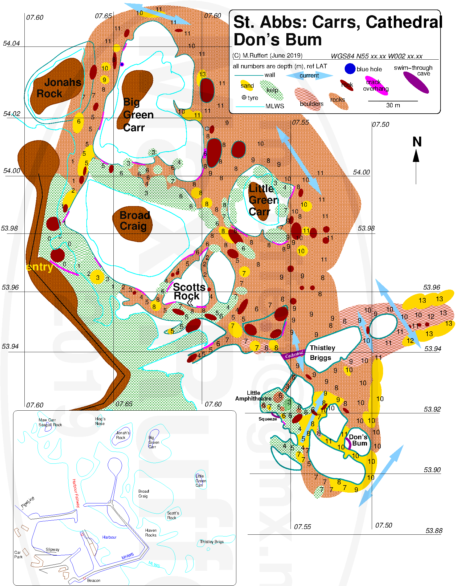
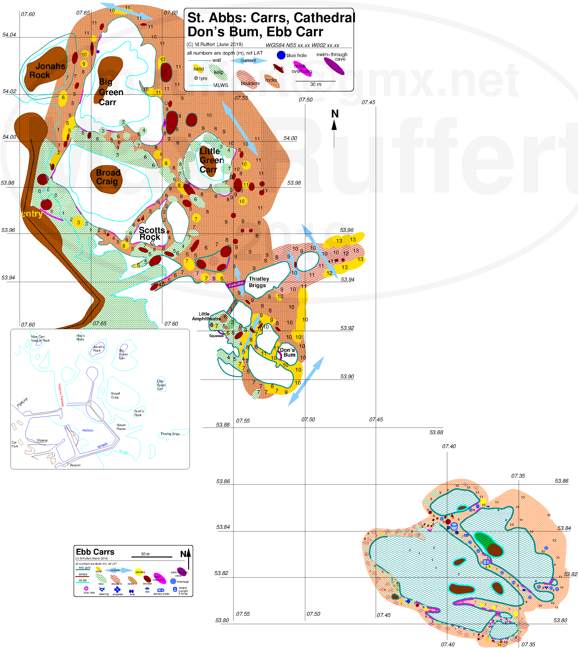
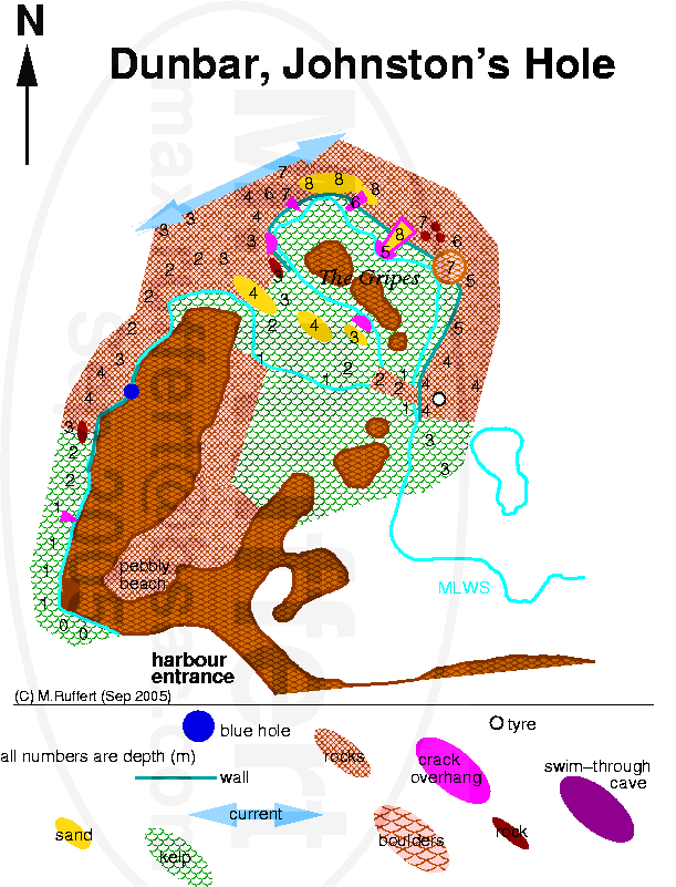
Cathedral Rock
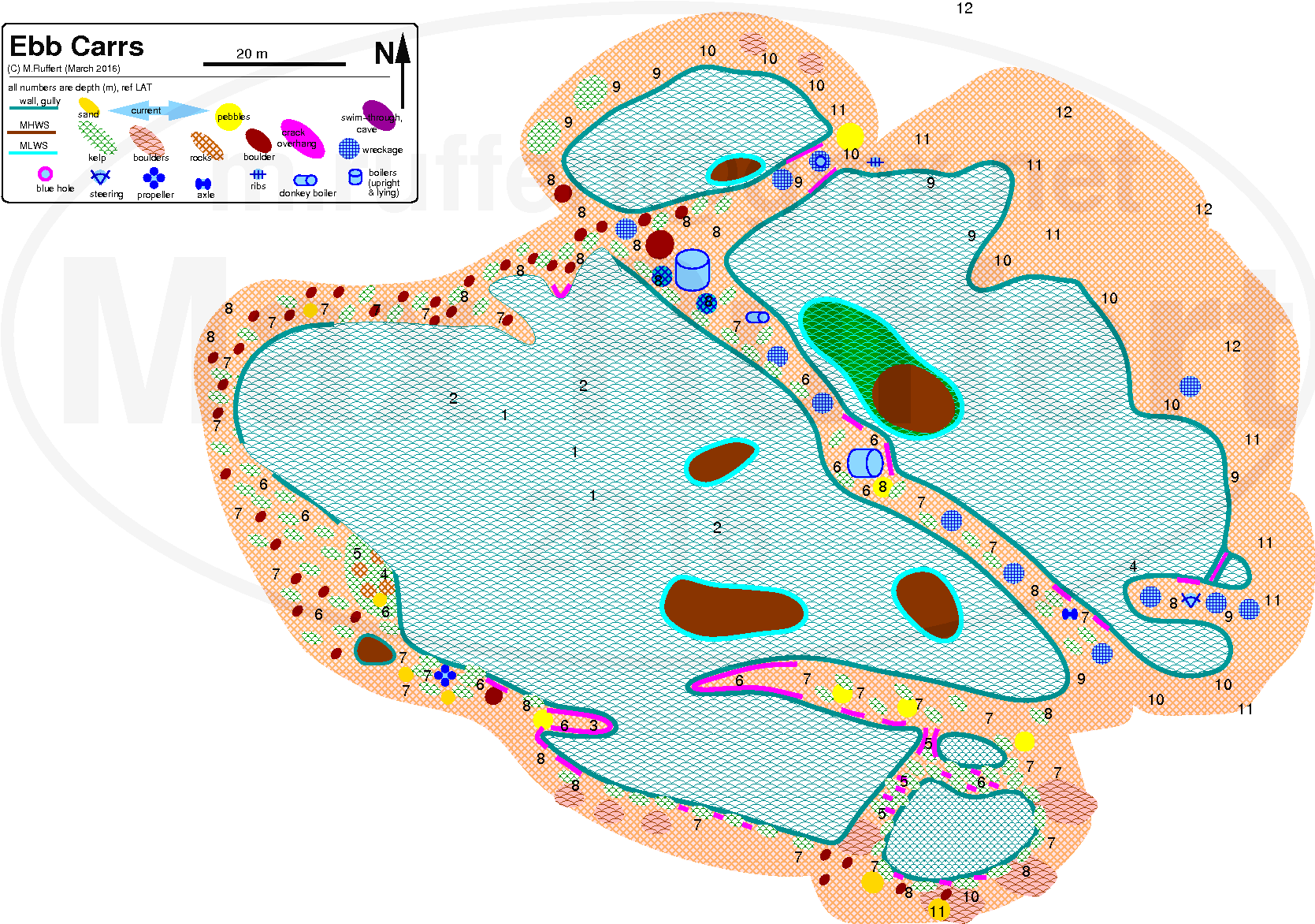
Ebb Carrs
Cathedral & Ebb Carrs
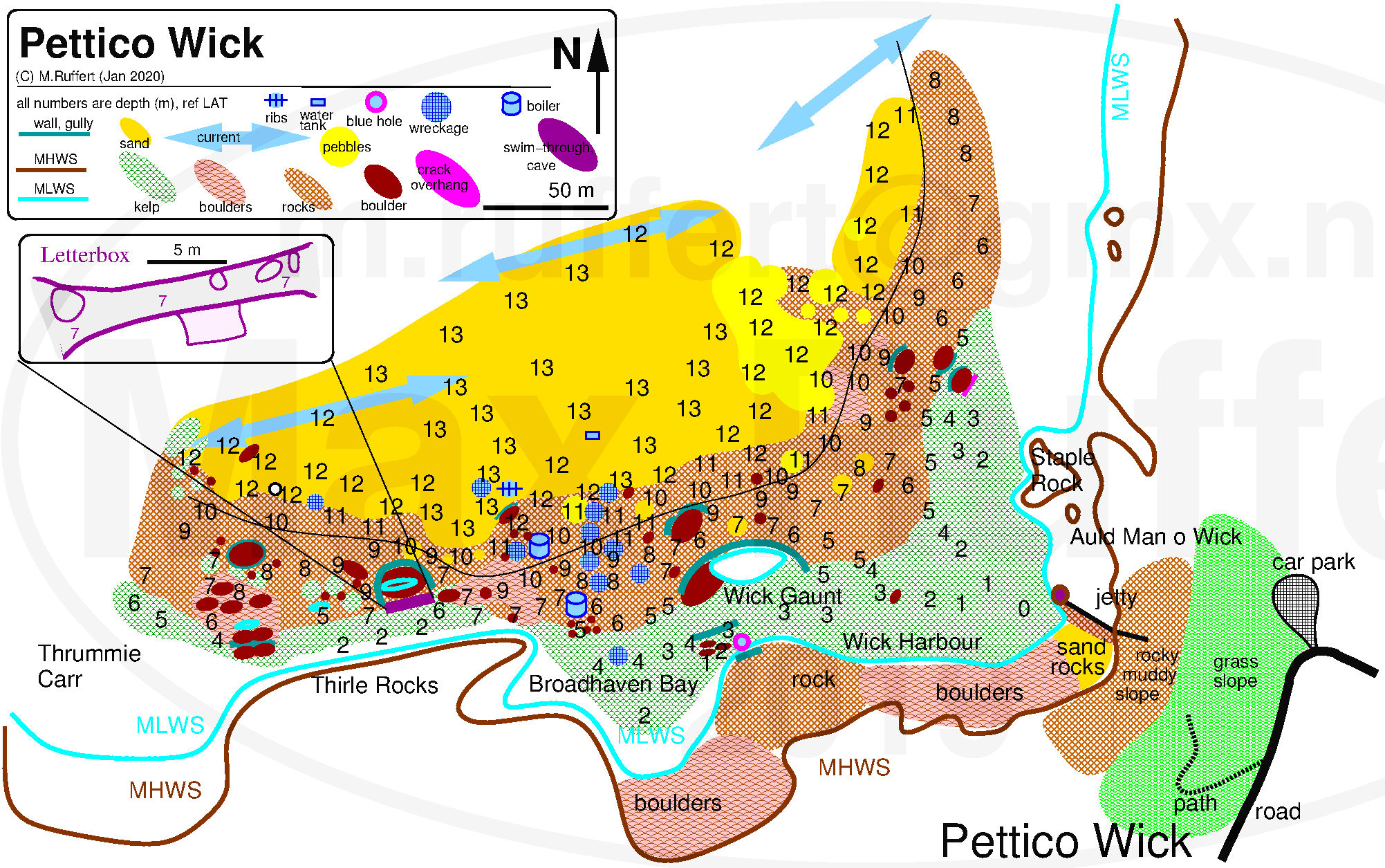
Petticowick
West Hurkers & Skelly Hole

Cathedral Rock | Ebb Carrs |
Cathedral & Ebb Carrs |
|---|---|---|
| |
|
|
Petticowick |
West Hurkers & Skelly Hole | |
| |
|
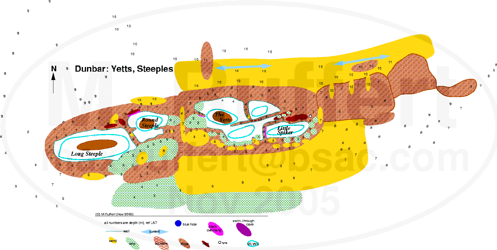
Yetts | Gripes |
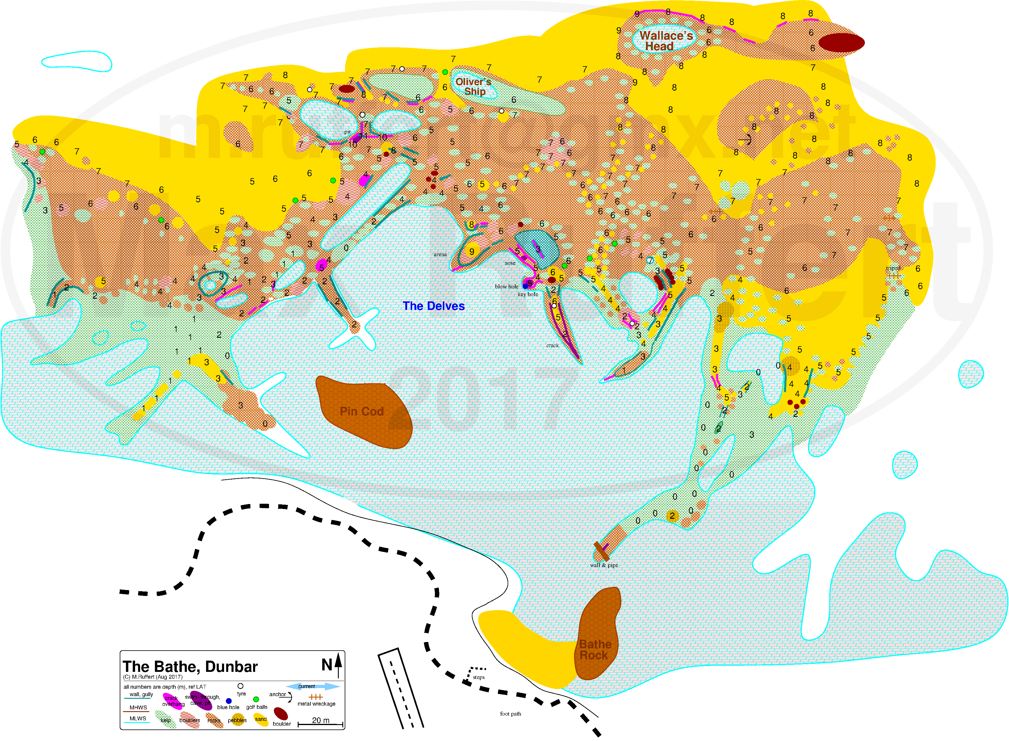
Bathe |
|---|---|---|
 |
 |
 |
Greenends & Nestends |
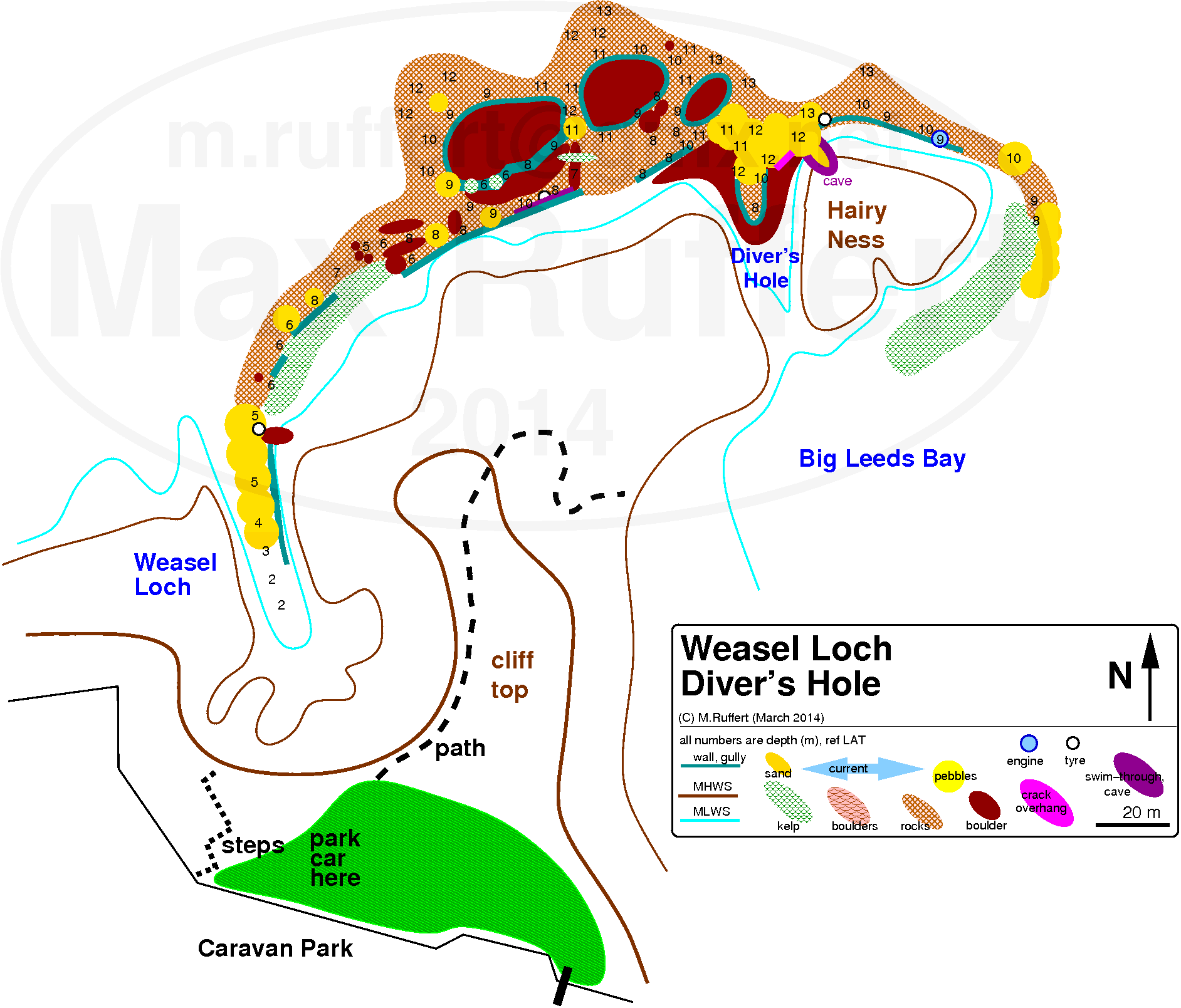
Weasel Loch |
|---|---|
 |
 |
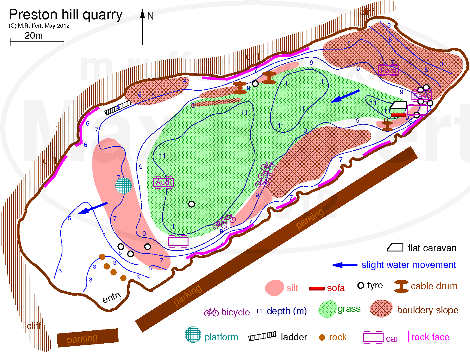 (2012)
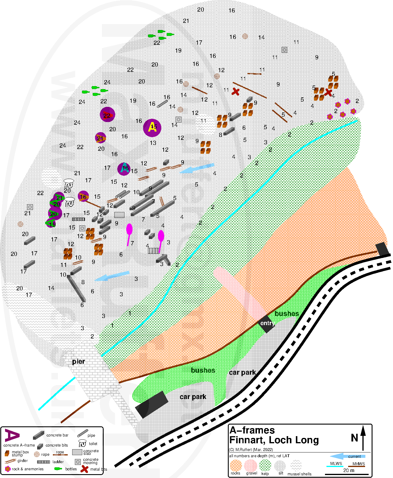
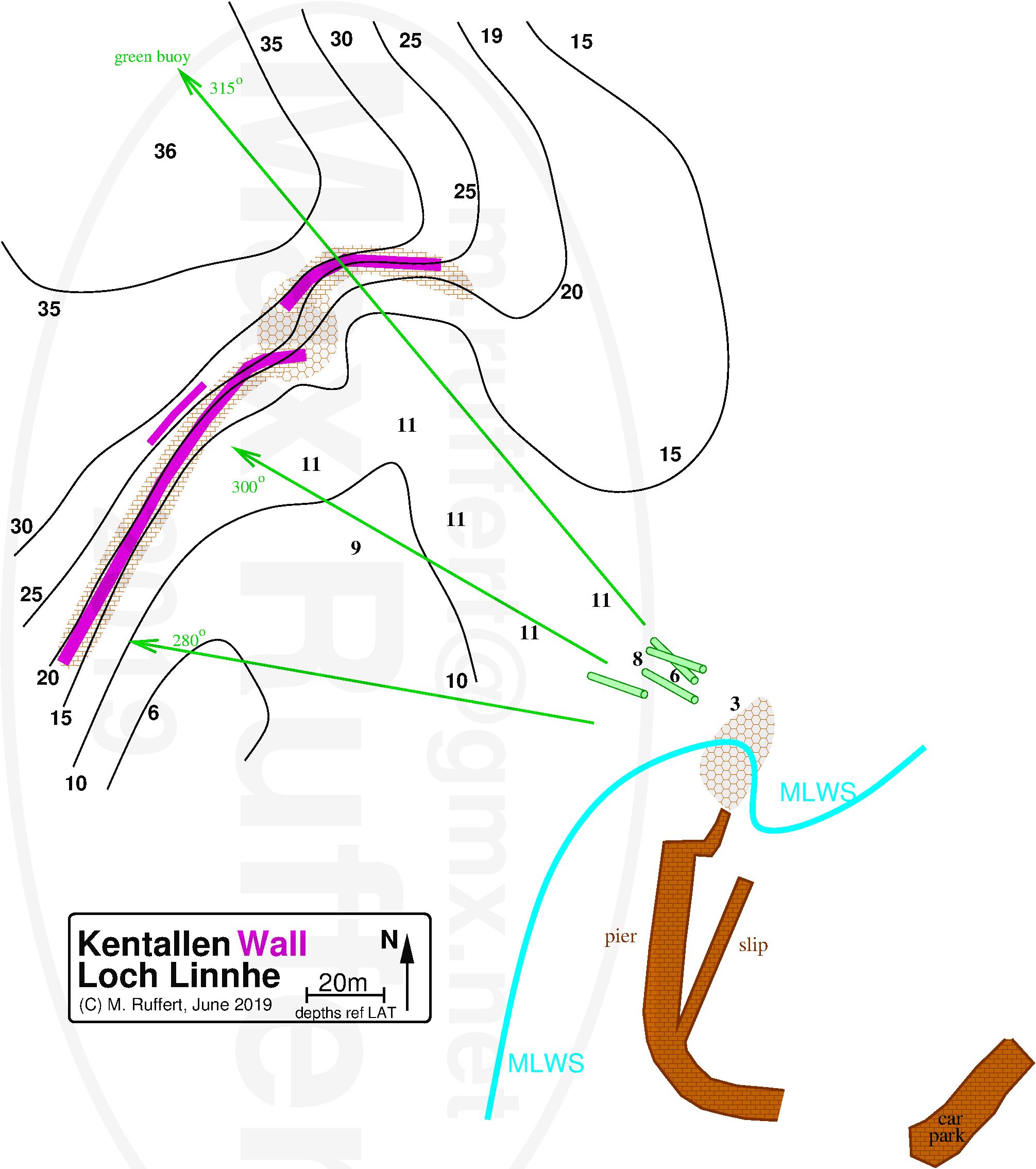
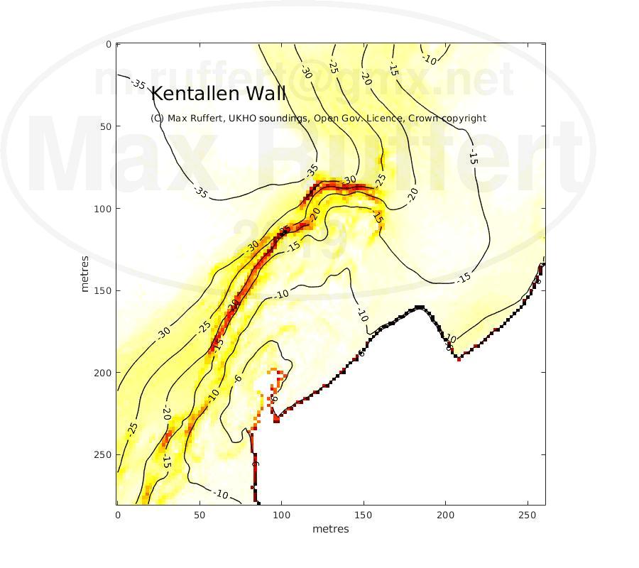
| A-frames / Finnart | |||
|---|---|---|---|
 | |||
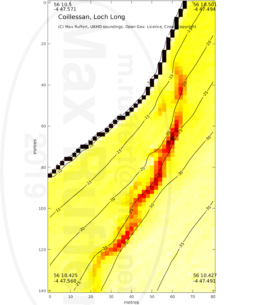
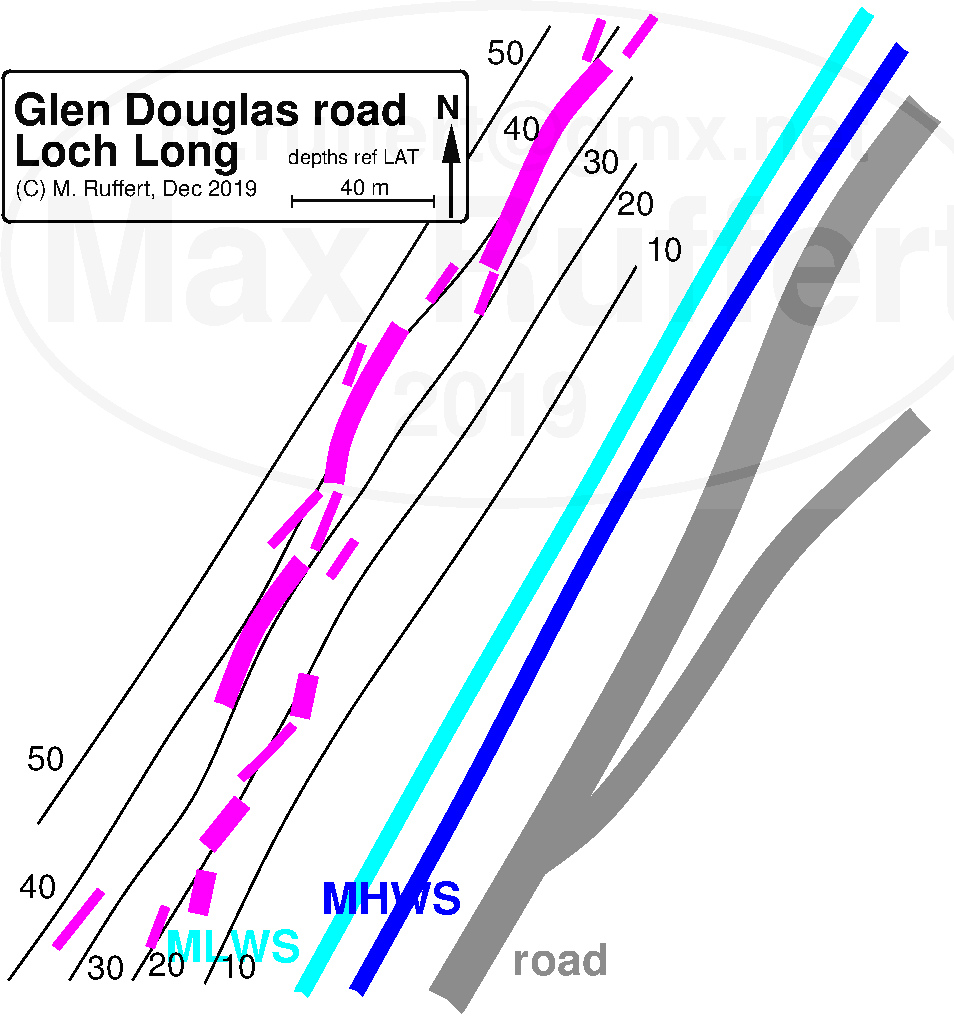
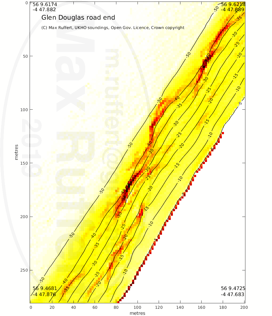
| Coillessan site | Coillessan wall | Glen Douglas road end site | Glen Douglas road end reef |
 |
 |
 |
 |
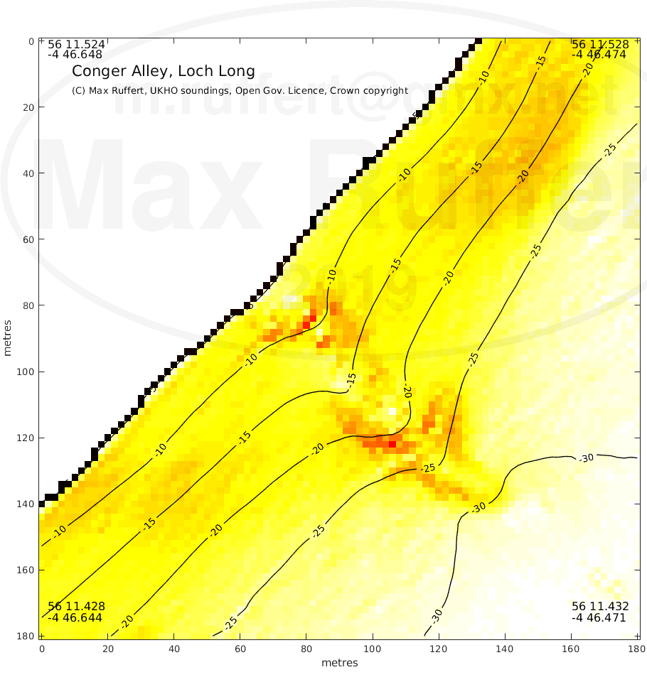
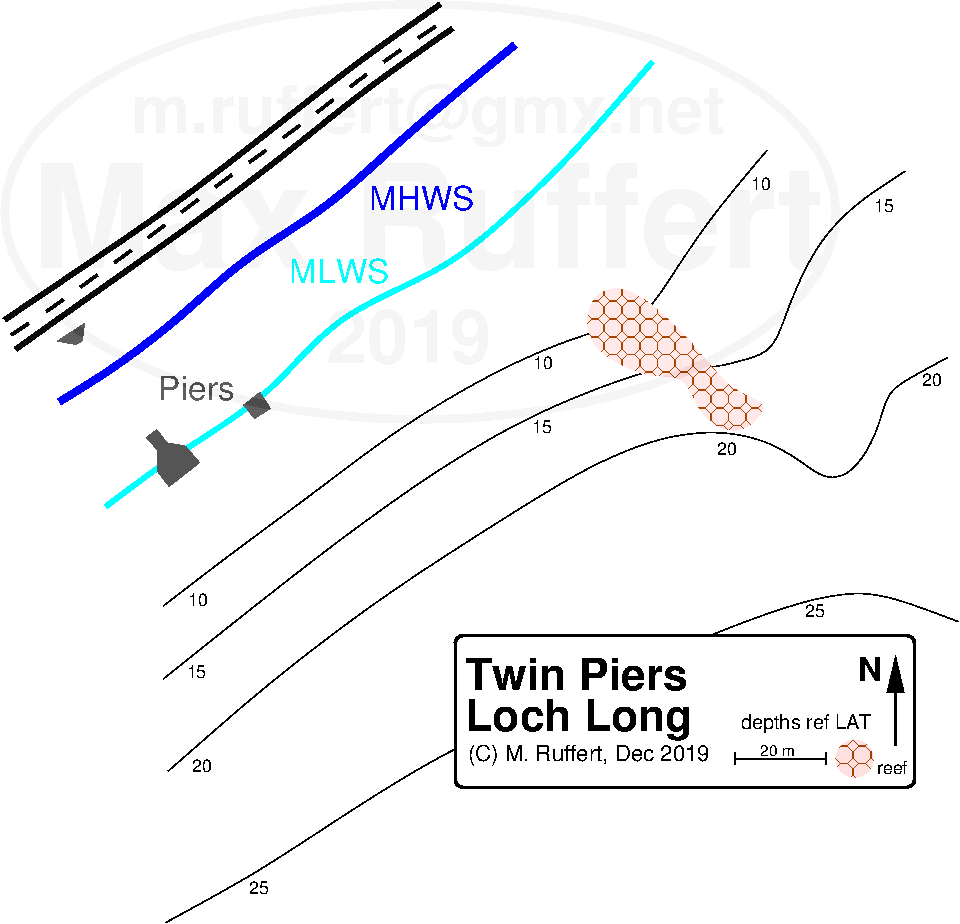
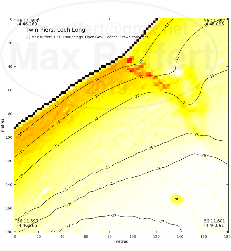
| Conger Alley site | Conger Alley reef | Twin Piers site | Twin Piers reef | 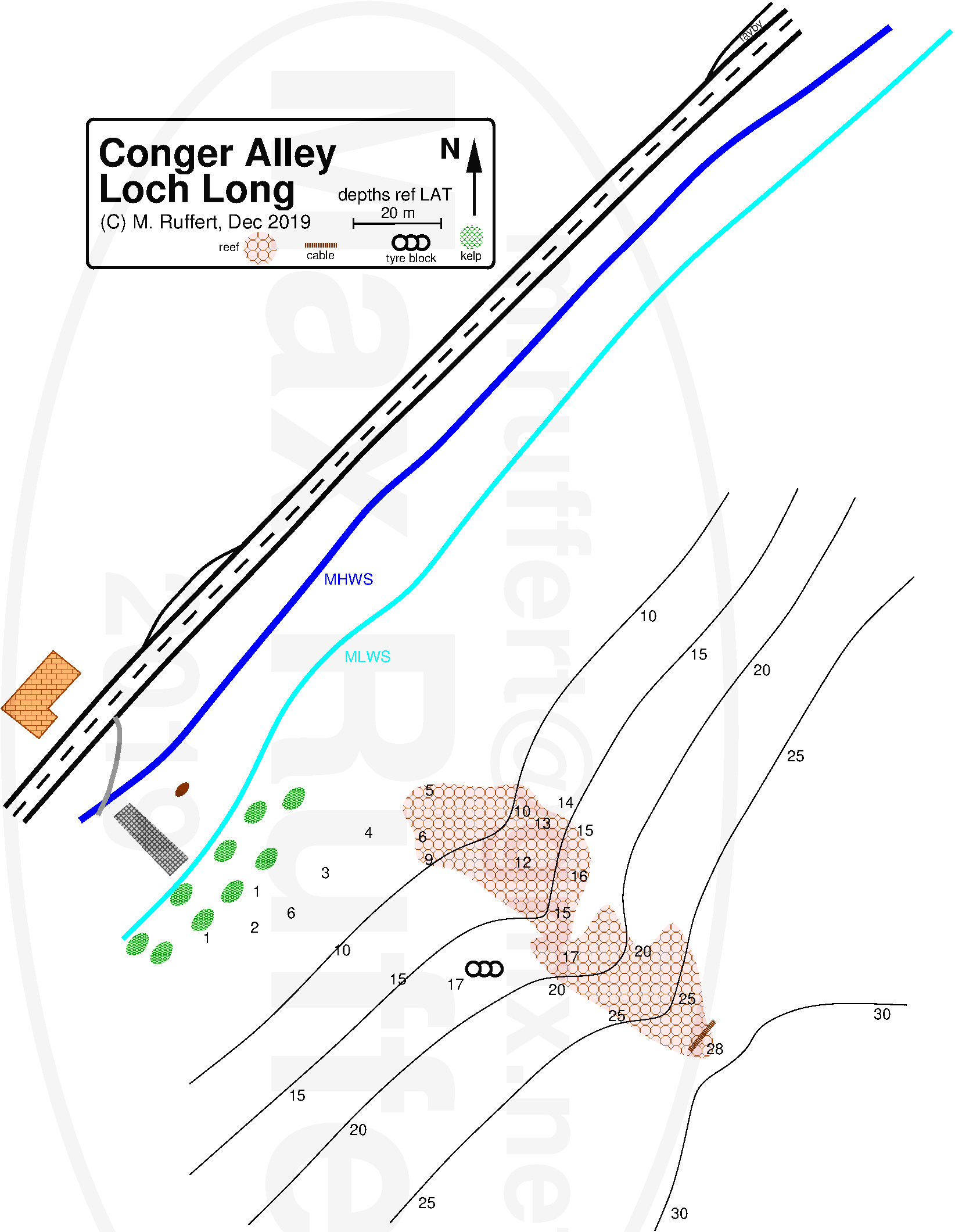 |
 |
 |
 |
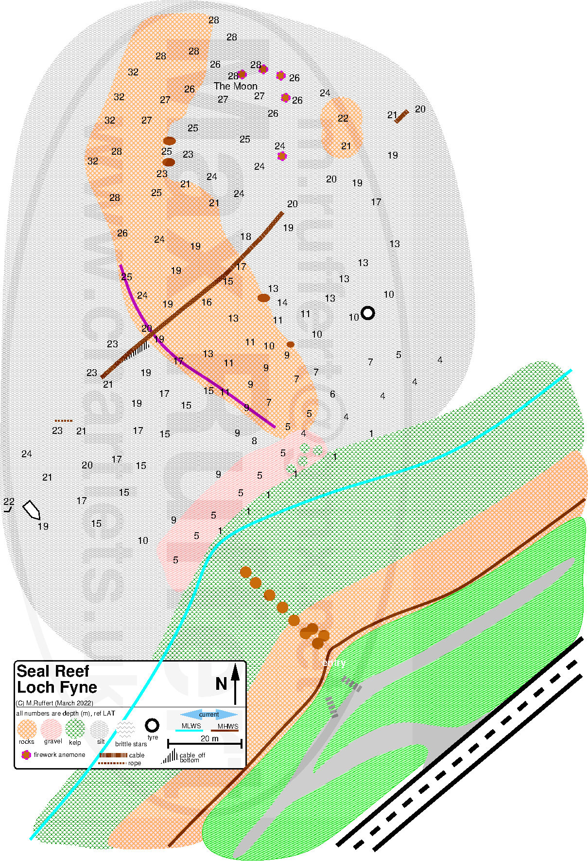
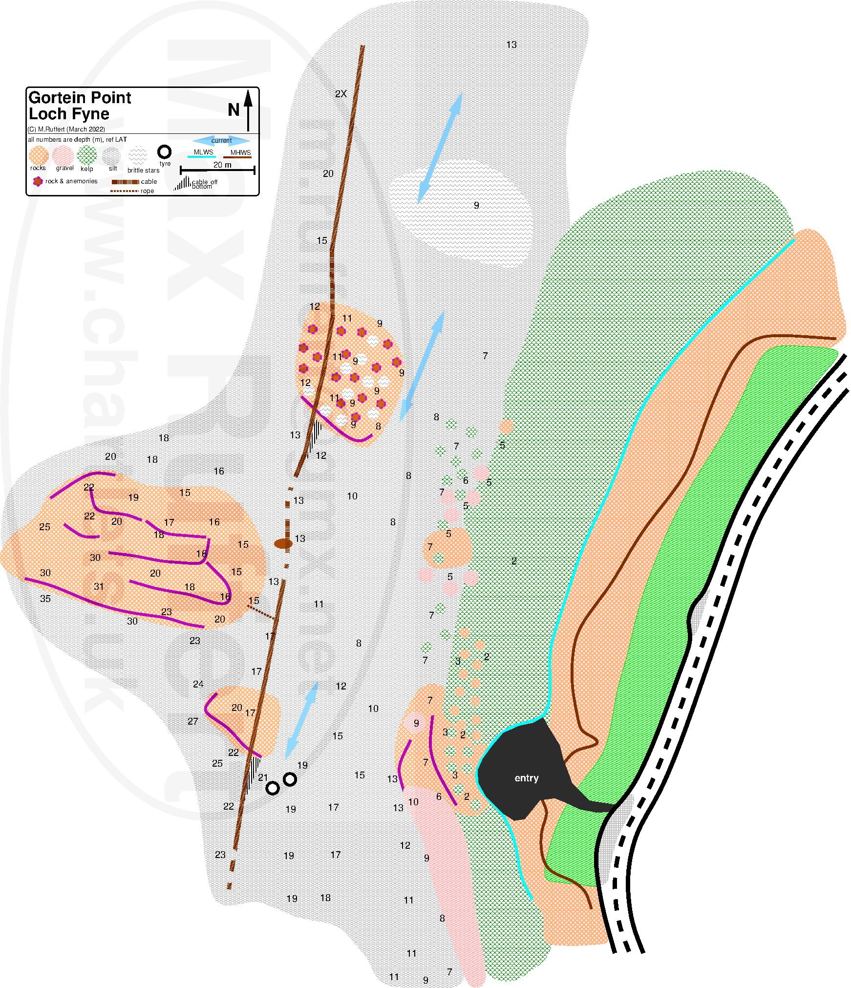
| Seal Reef | Gortein Point |
|---|---|
 |
 |


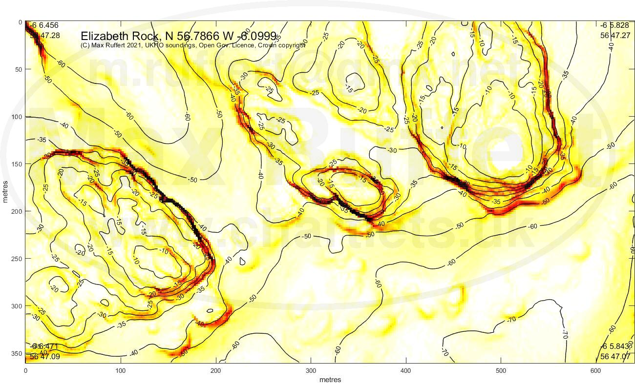
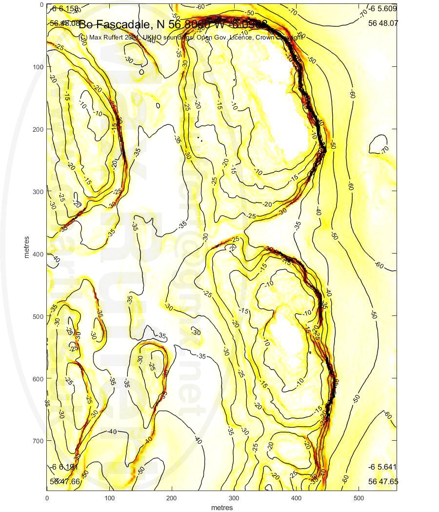
Elizabeth Rock | Bo Fascadale |
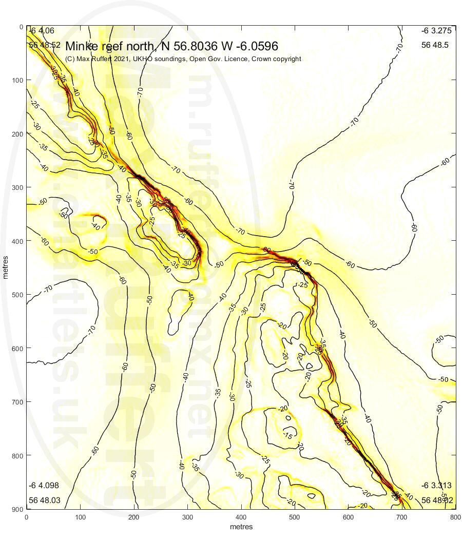
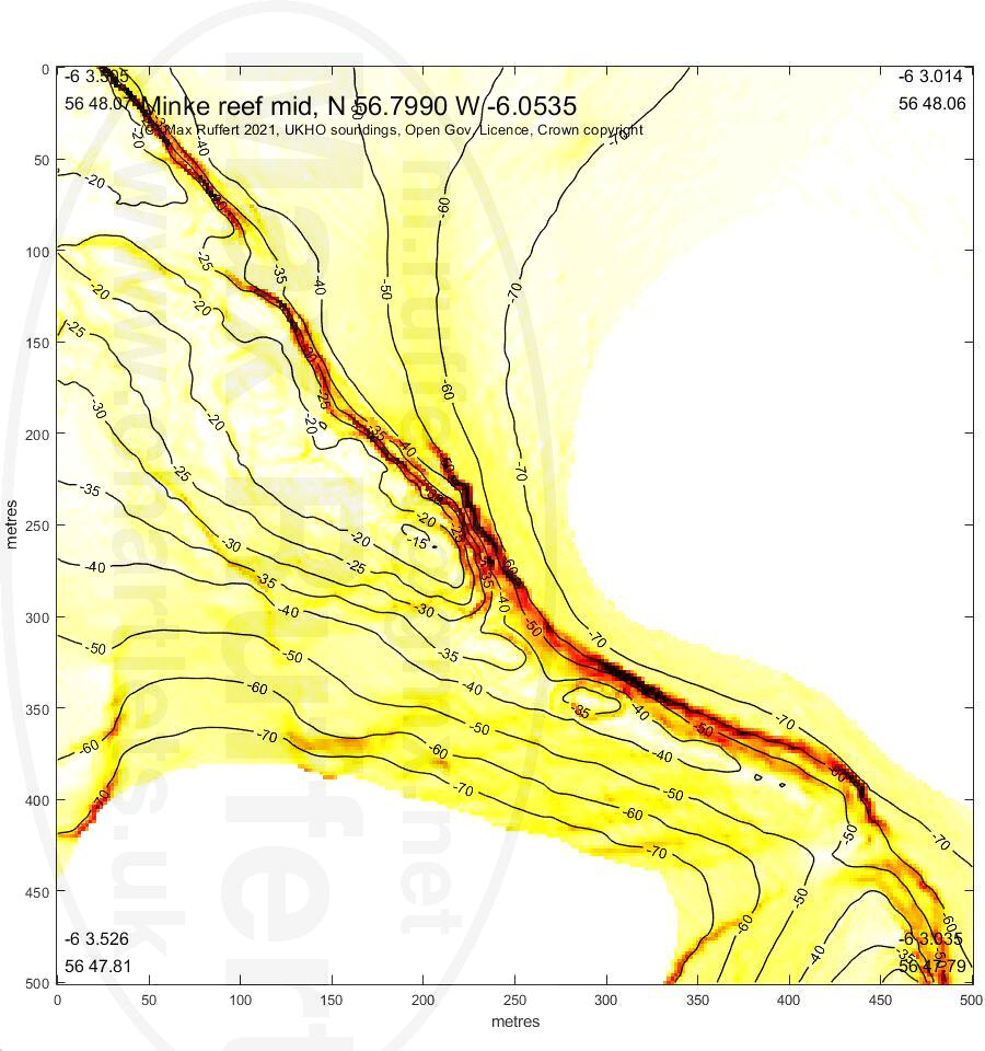
Minke reef N | Minke reef mid |
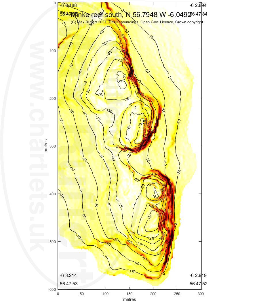
Minke reef S |
|---|---|---|---|---|
 |
 |
 |
 |
 |
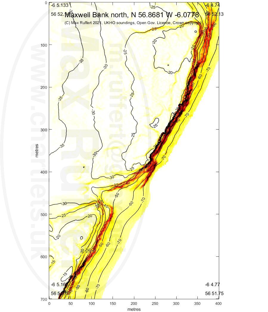
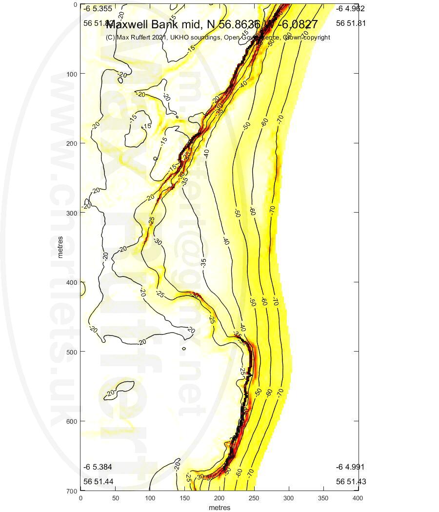
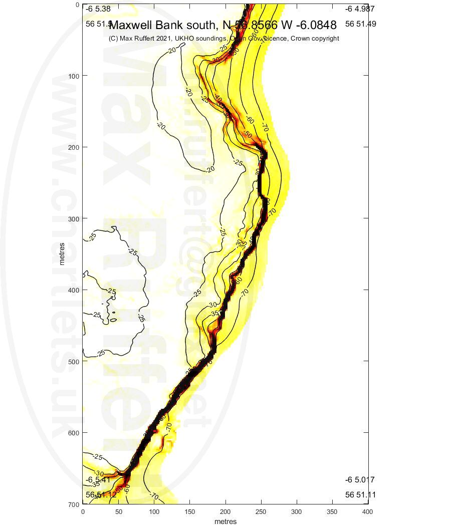
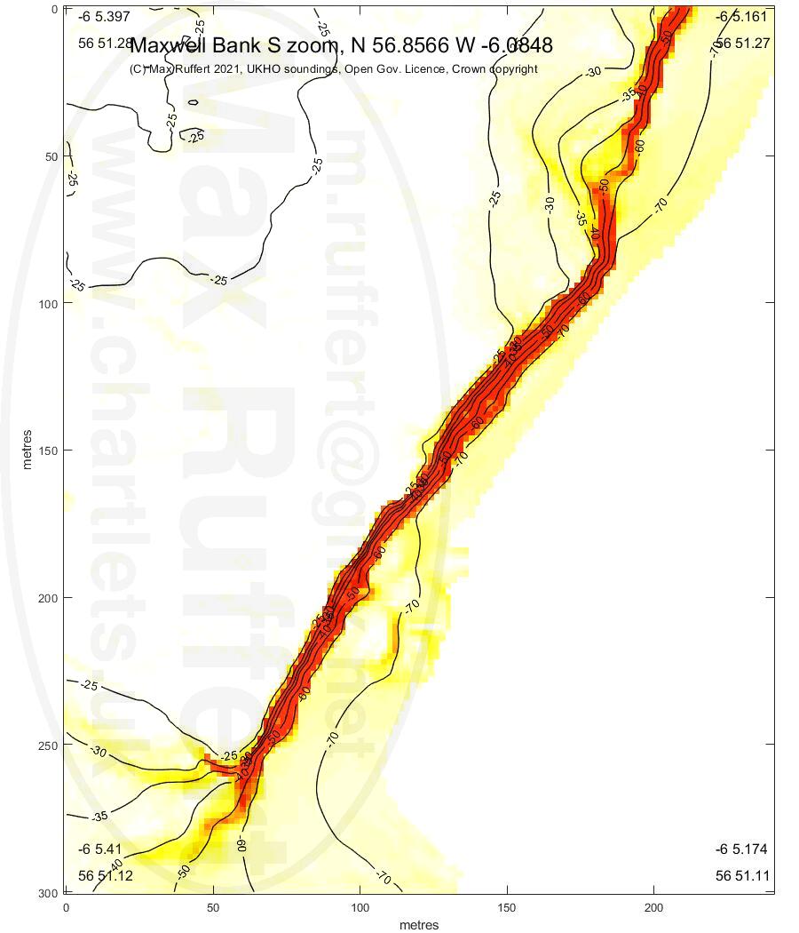
Maxwell N | Maxwell mid |
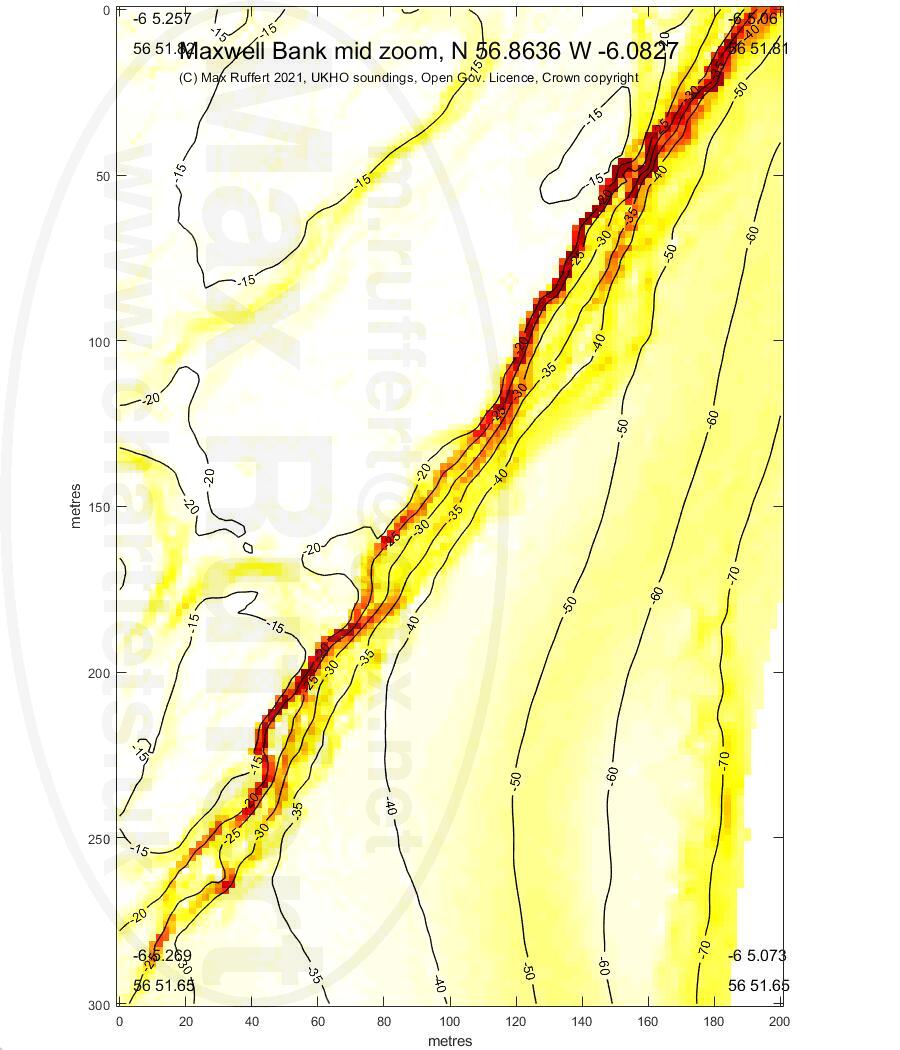
Maxwell mid zoom | Maxwell S |
Maxwell S zoom |
 |
 |
 |
 |
 |
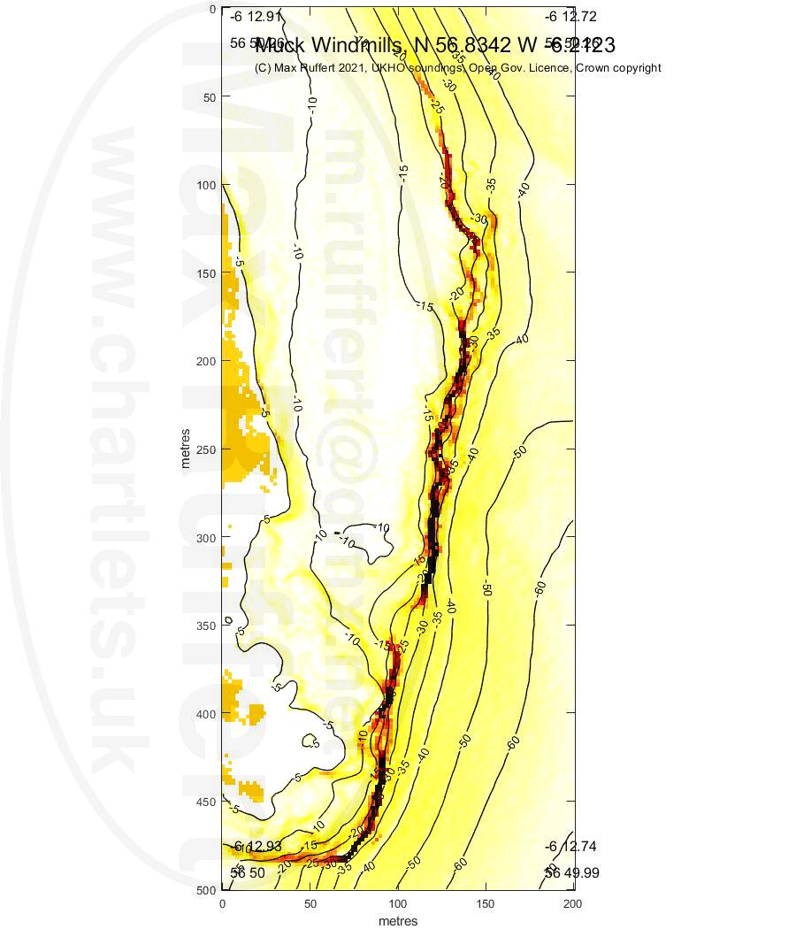
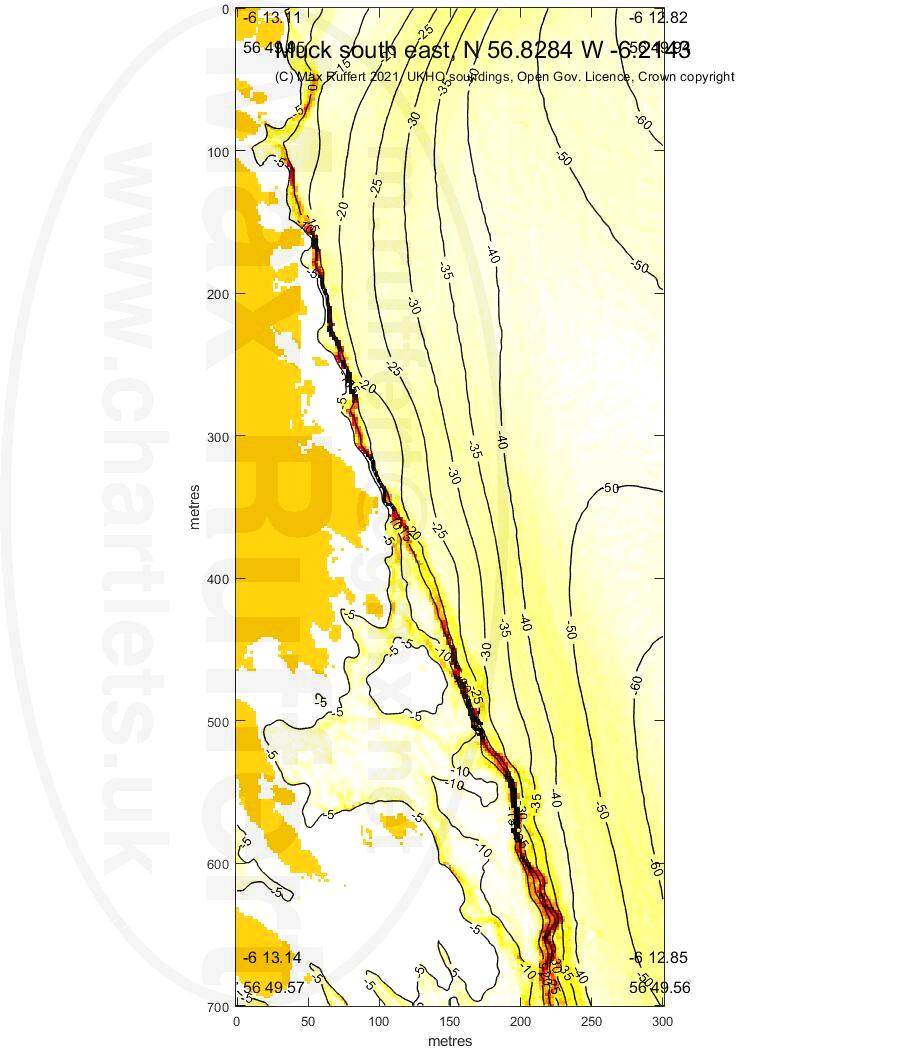
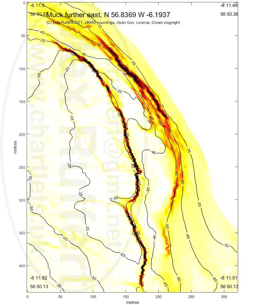
Muck windmills | Muck SE |
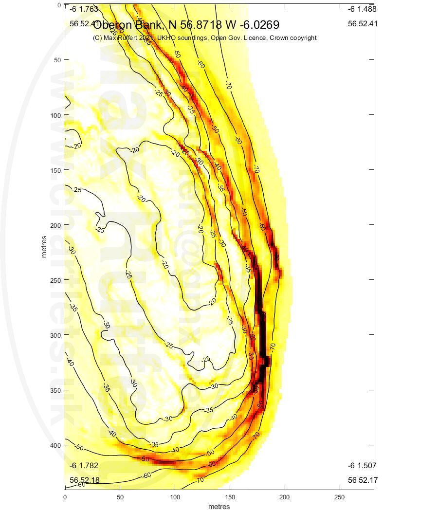
Muck E | Oberon bank |
|
 |
 |
 |
 |
|
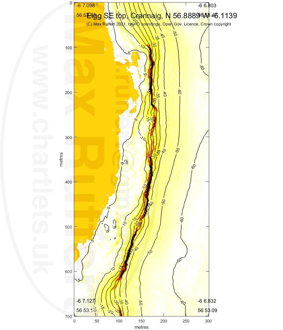
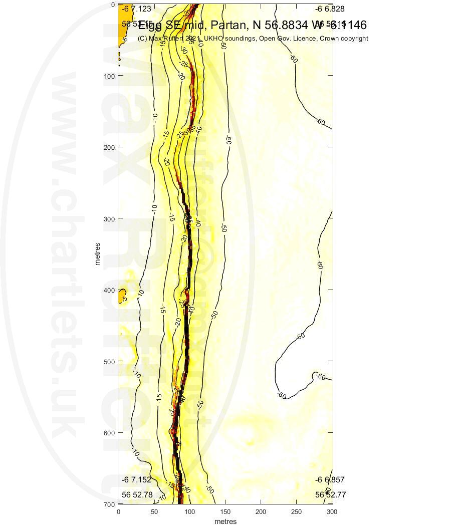
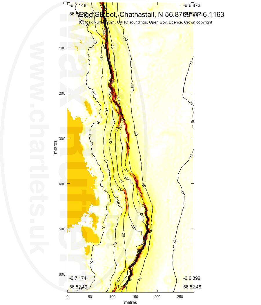
Eigg SE Crannaig | Eigg SE Partan |
Eigg SE Chathastail |
||
 |
 |
 |
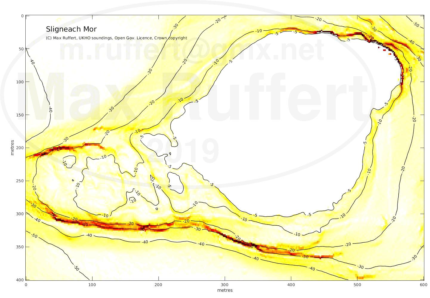
Sligneach Mor | Sligneach Beag |
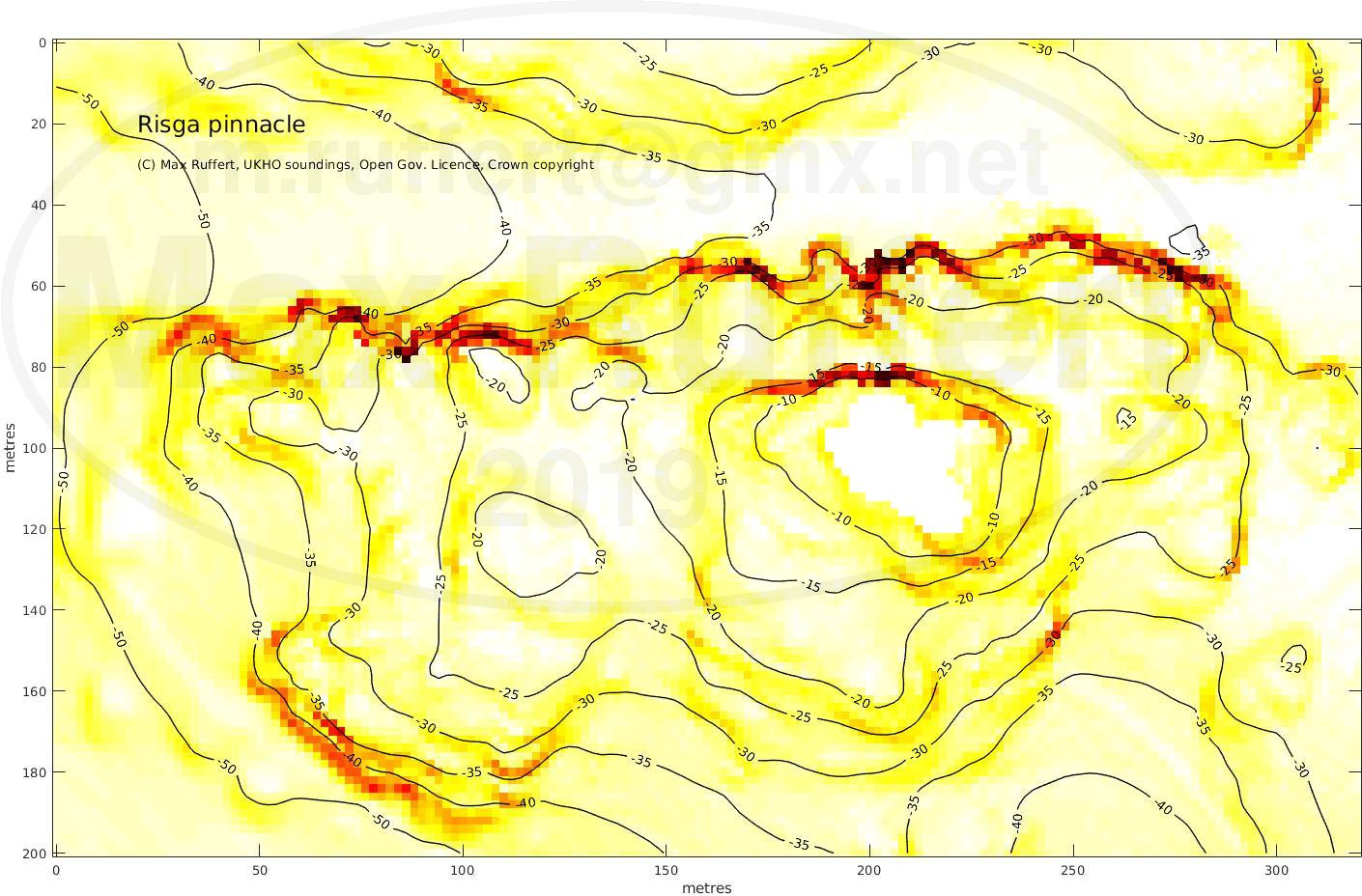
Risga Pinnacle | Broad Rock |
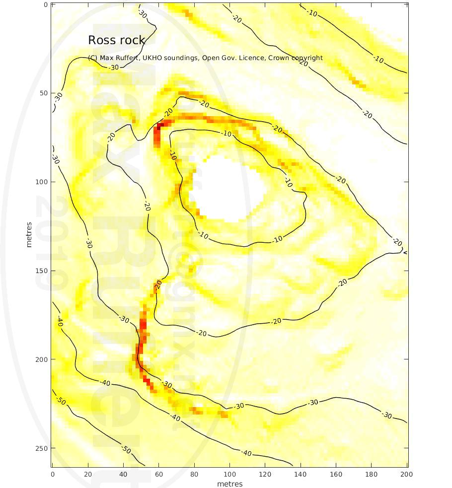
Ross rock |
|---|---|---|---|---|
 |
 |
 |
 |
 |
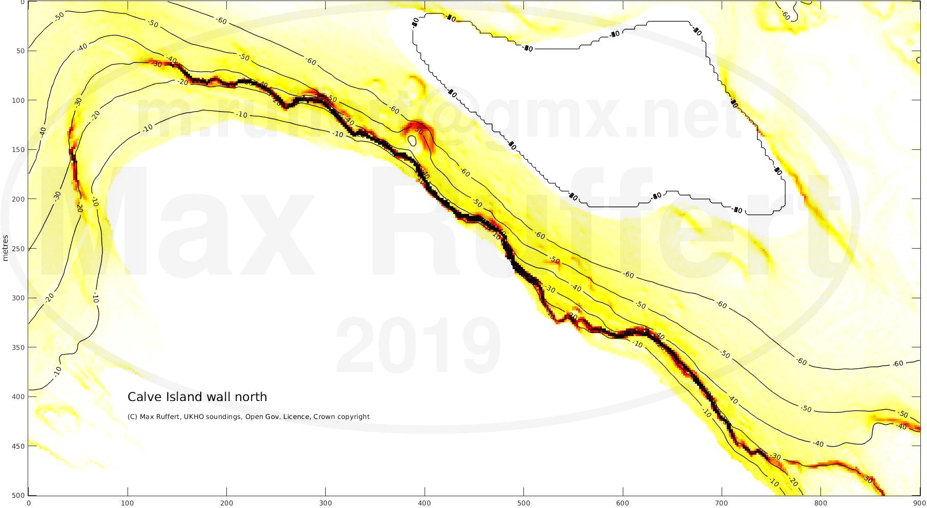
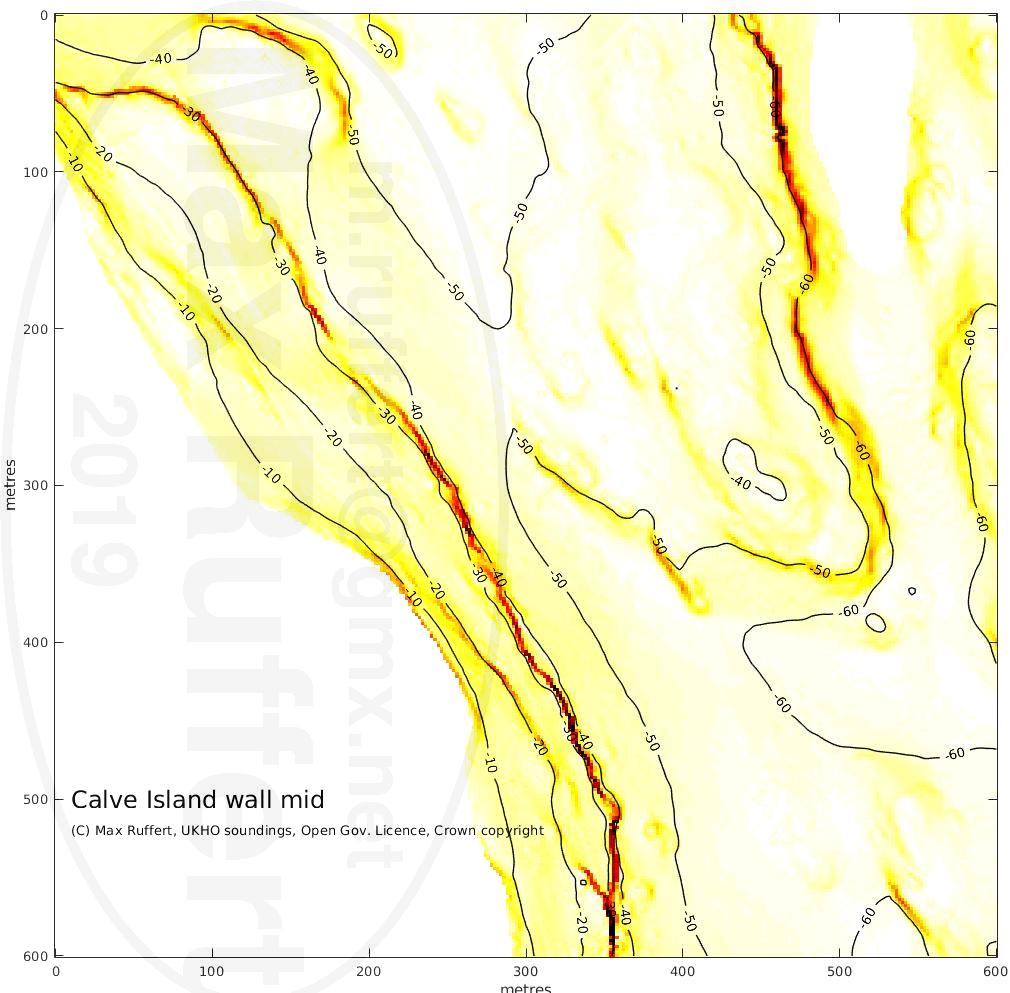
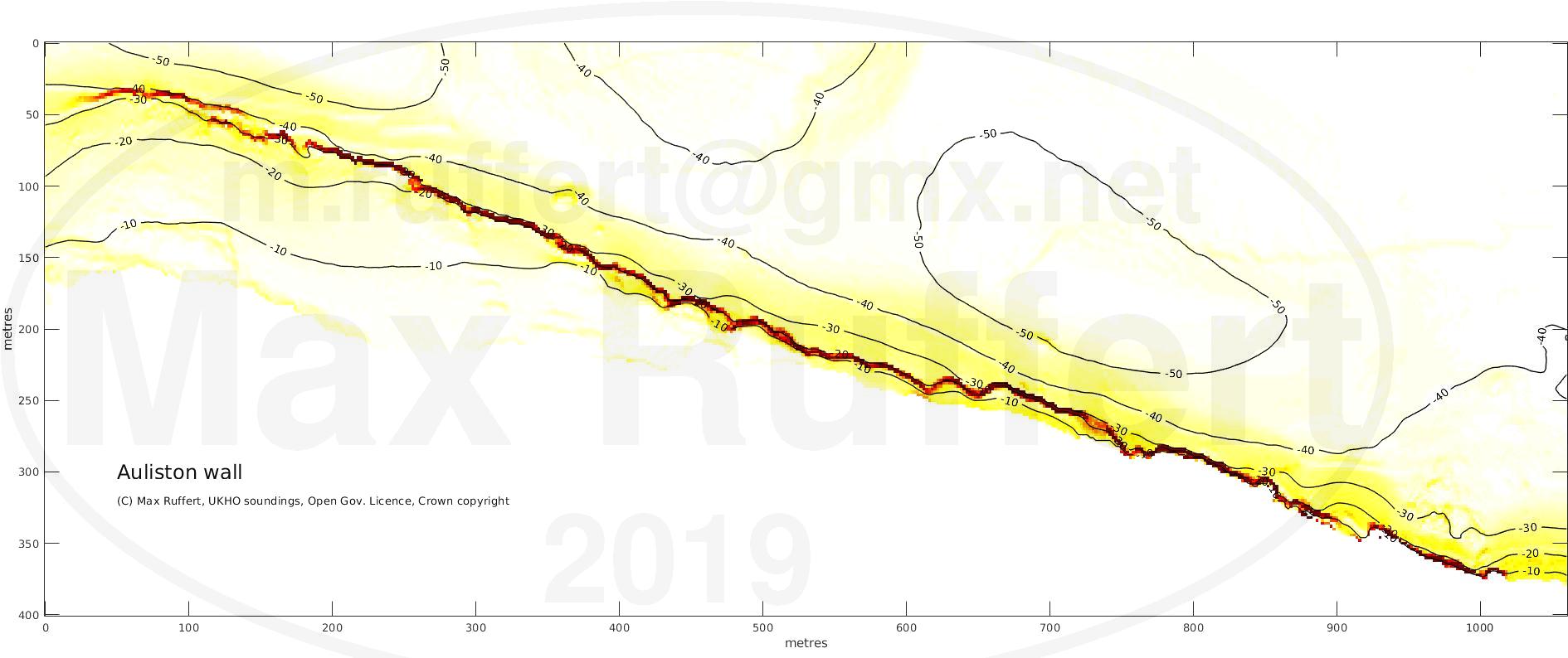
Calve Island wall | Auliston wall |
||||||
|---|---|---|---|---|---|---|---|
|
 | ||||||
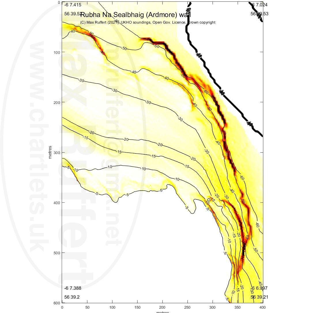
Sealbhaig (Ardmore) |
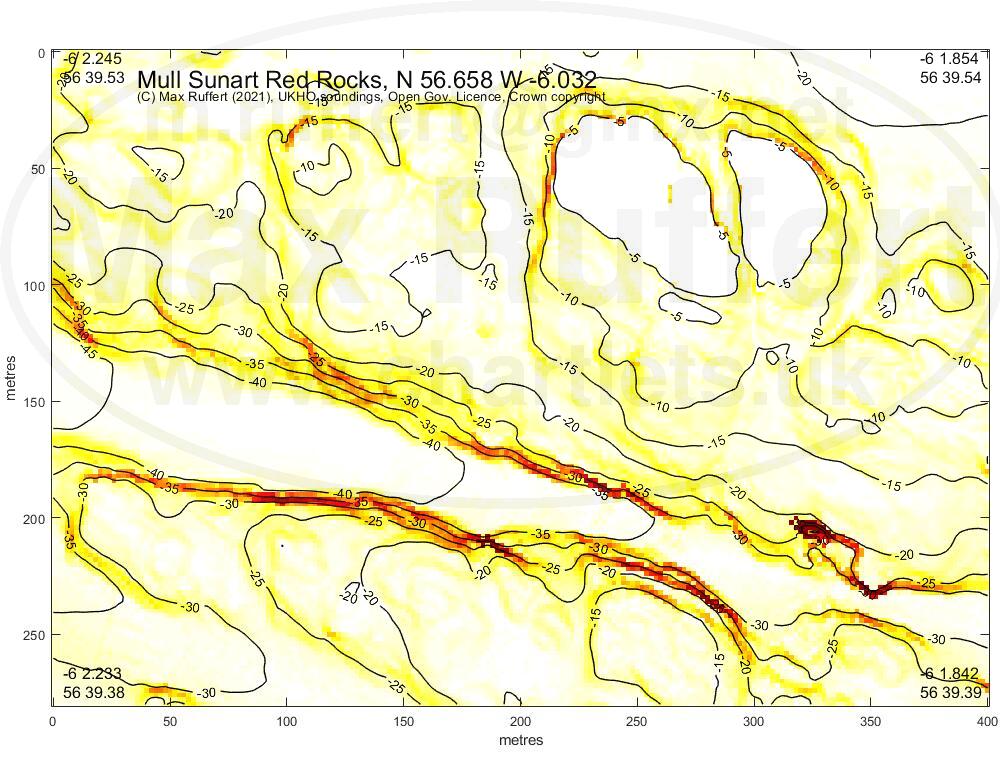
Red Rocks gully |
|---|---|
 |
 |
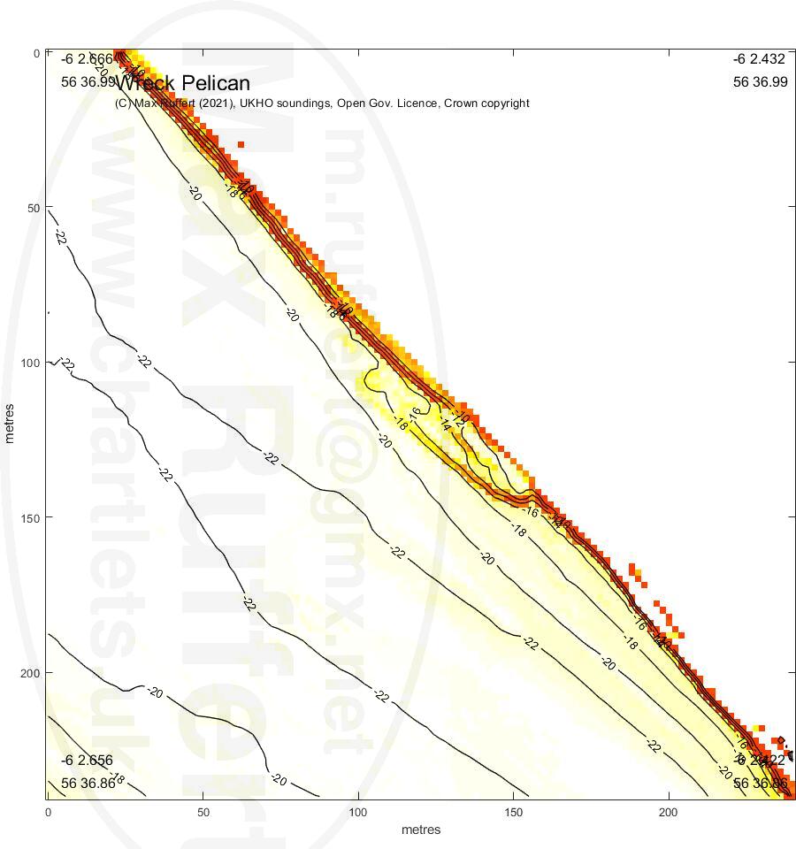
Wreck Pelican |
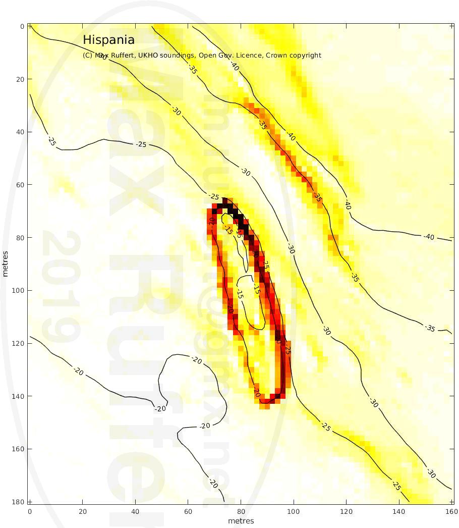
Wreck Hispania |
Wreck Rondo & Am Brican |
|---|---|---|
 |
 |
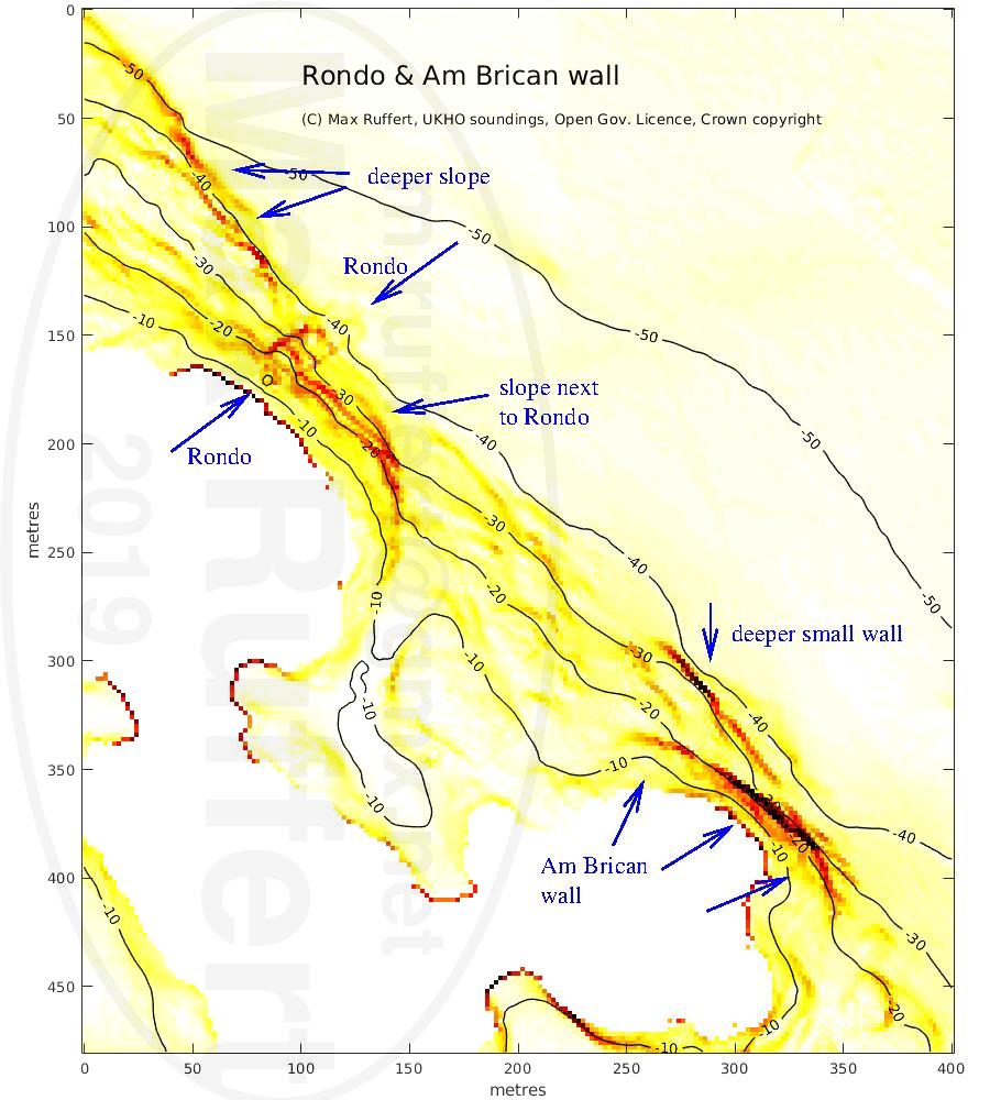 |
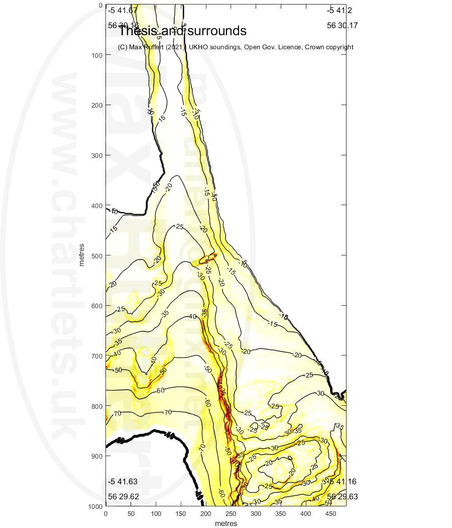
This was the state of tide when I dived the Hispania, Thesis, Rondo and Shuna.
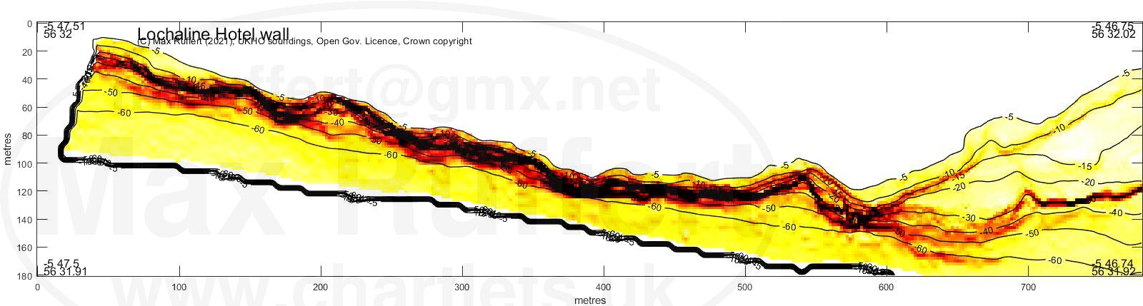
Lochaline Hotel wall |
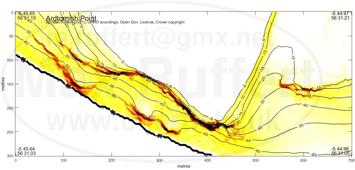
Ardtornish Point |
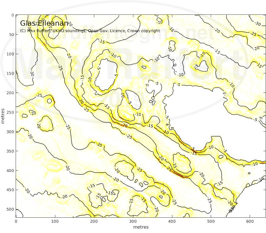
Glas Eileanan | Thesis |
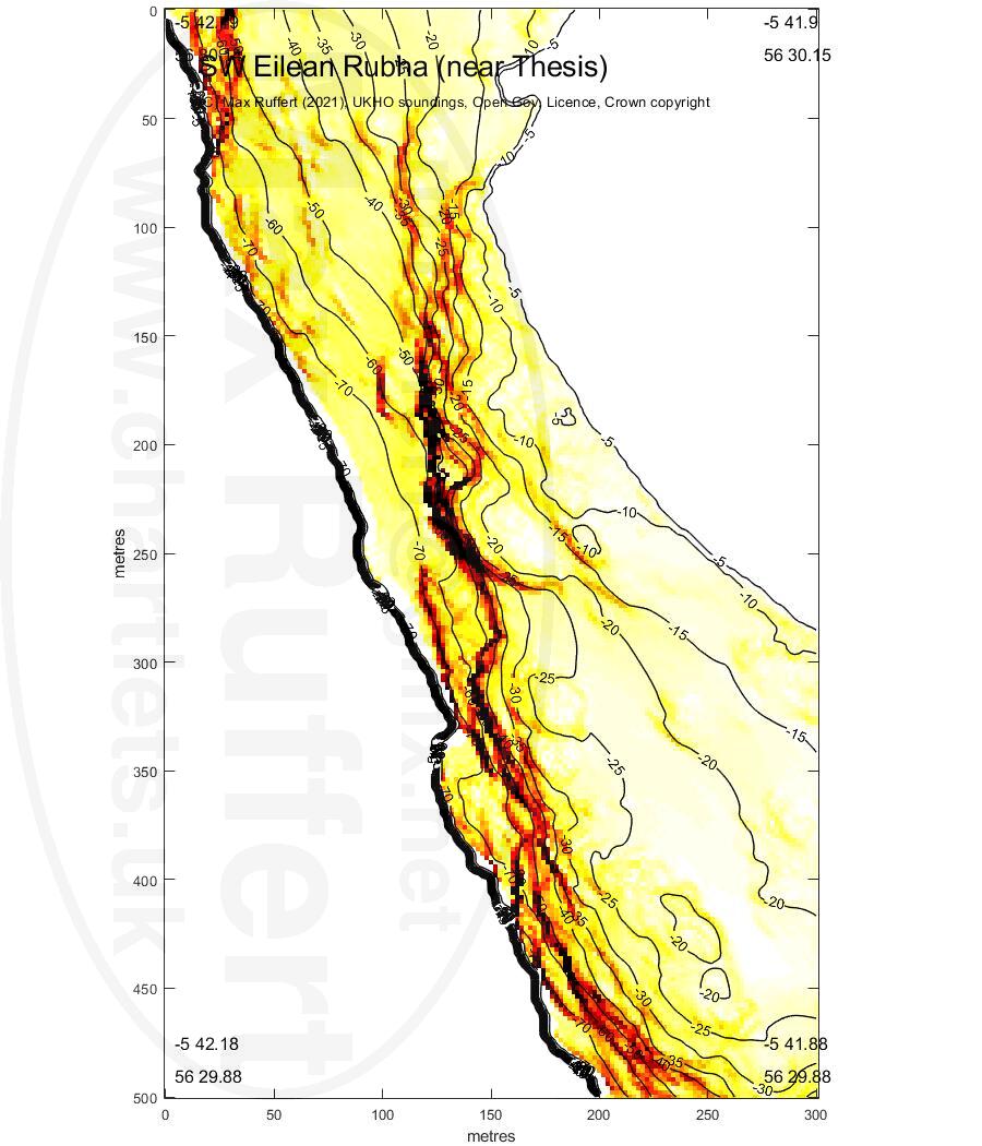
SW Eilean Rubha |
|---|---|---|---|---|
 |
 |
 |
 |
 |
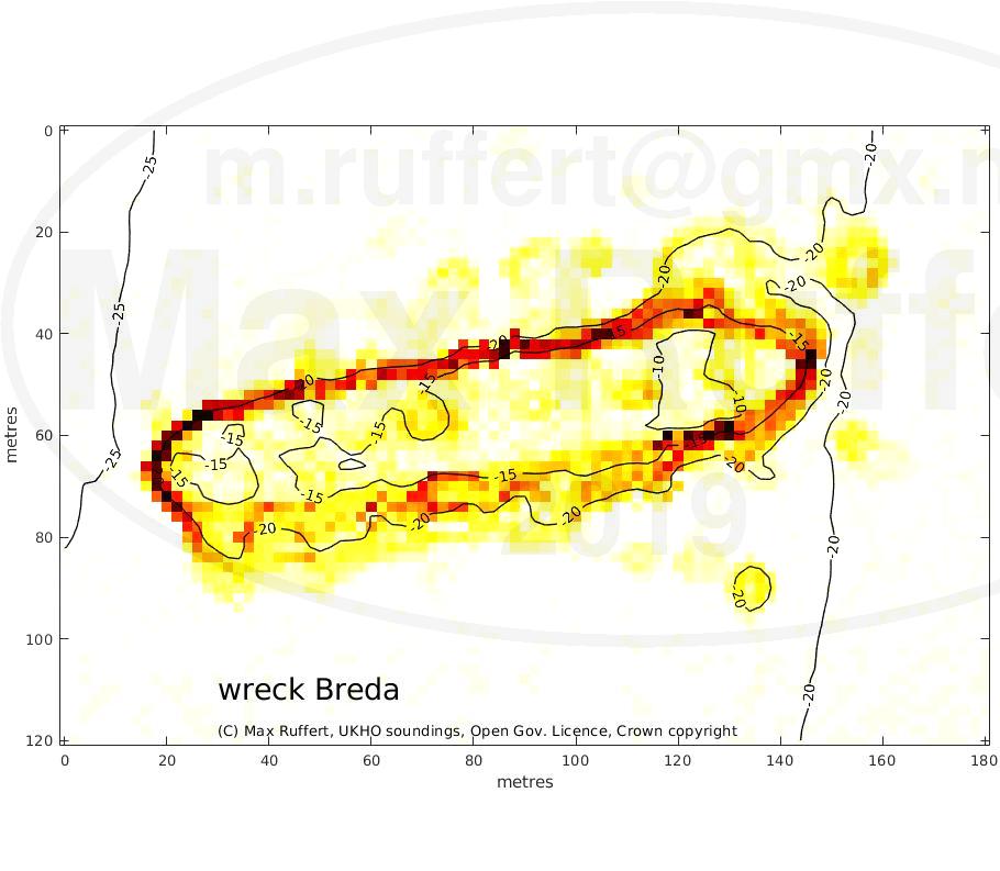
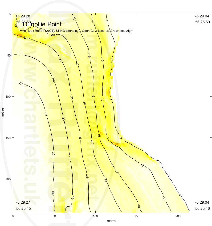
Wreck Breda | Dunollie Point |
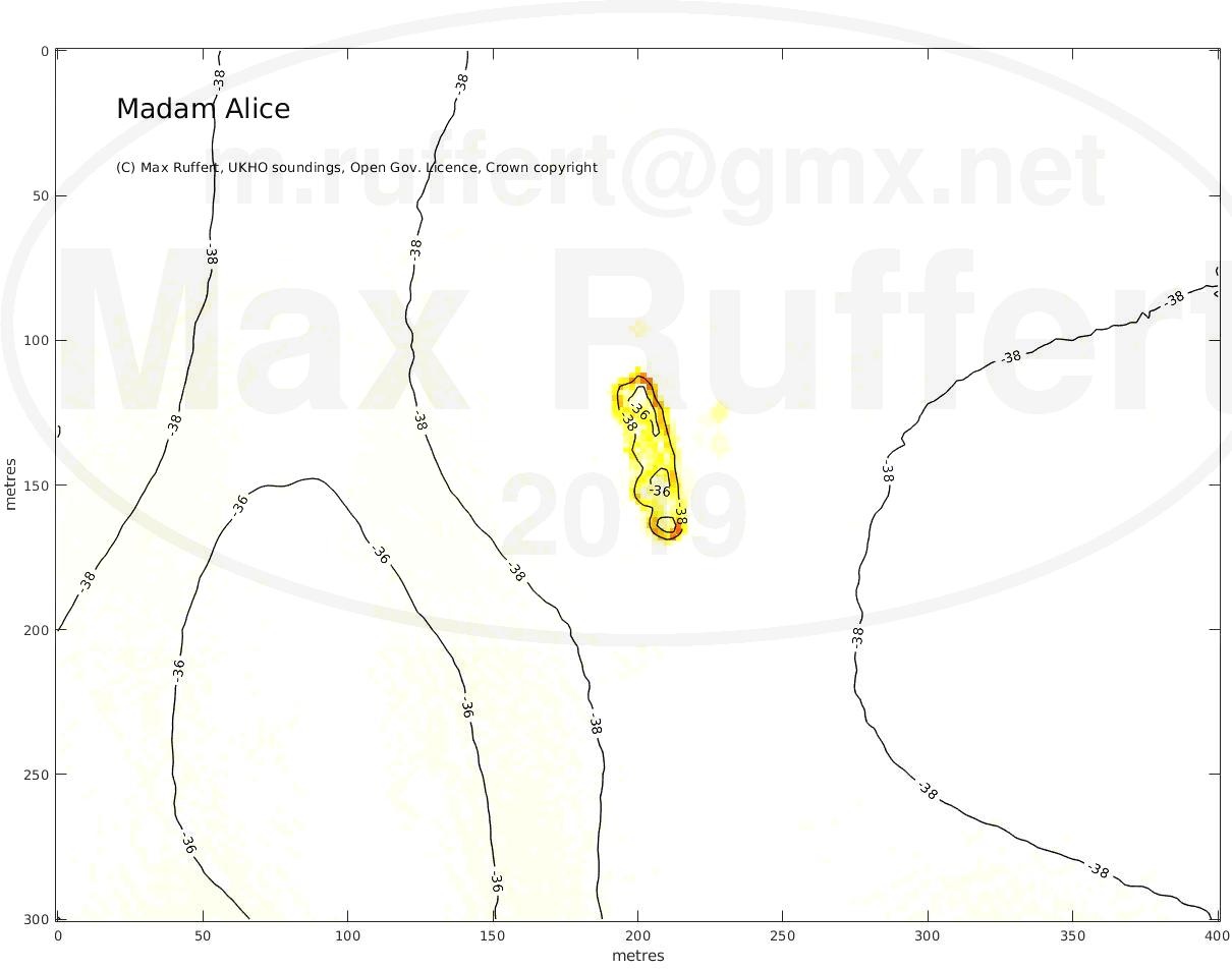
Madam Alice | |
|---|---|---|---|
 |
 |
 |
 |
Lady's Rock |
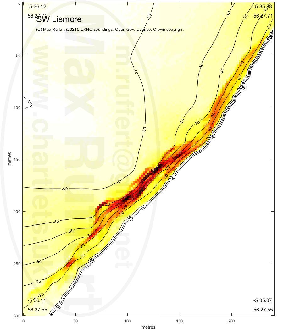
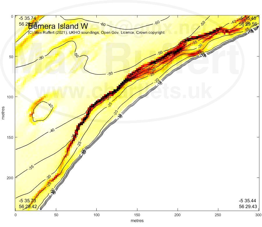
Lismore SW | Bernera W |
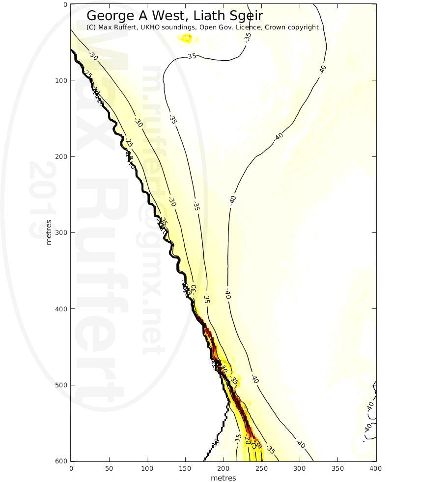
George A West, Liath Sgeir |
|---|---|---|---|
 |
 |
 |
 |
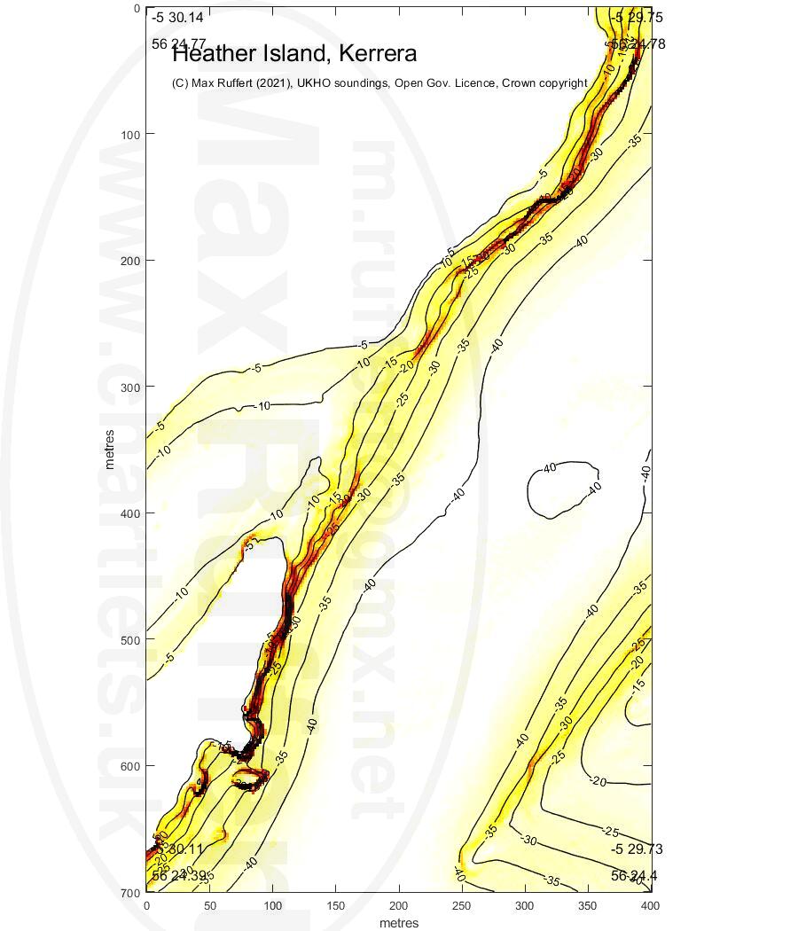
Heather Is. |
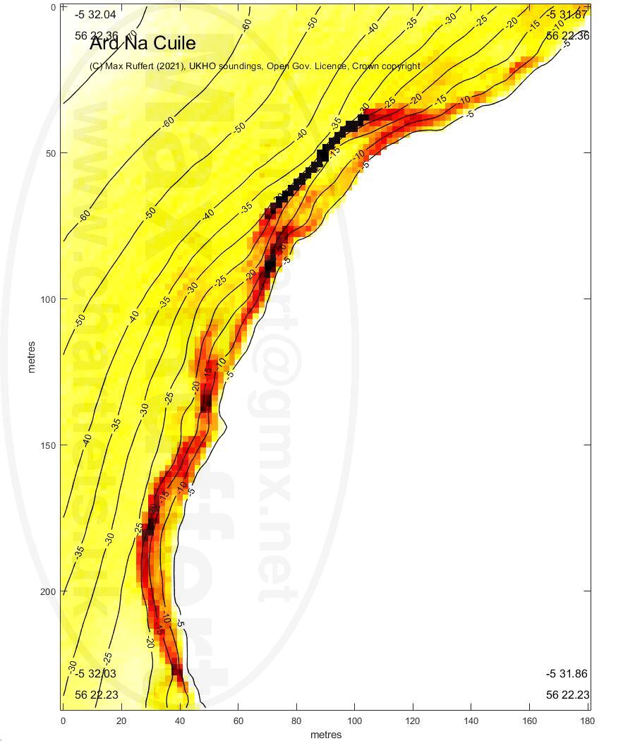
Ard Na Cuile |
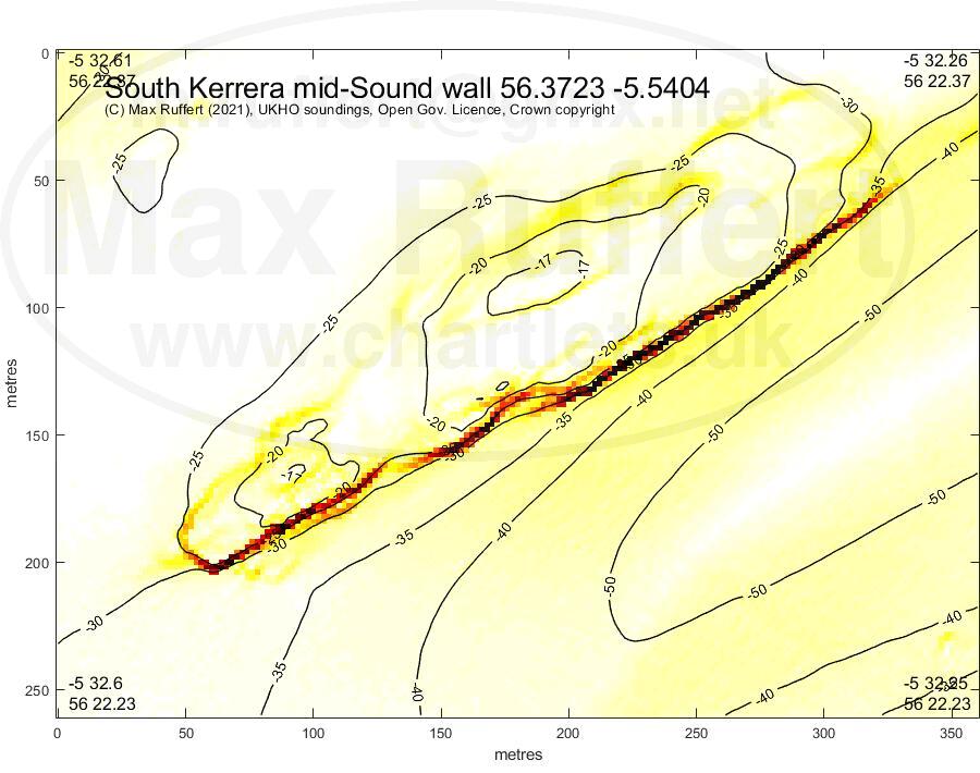
Kerrera S midsound |
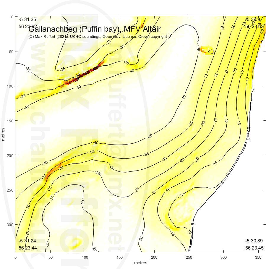
Gallanachbeg, MFV Altair |
|---|---|---|---|
 |
 |
 |
 |
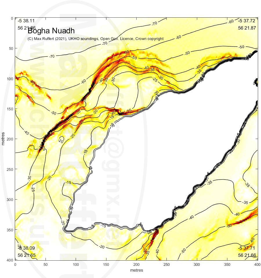
Bogha Nuadh |
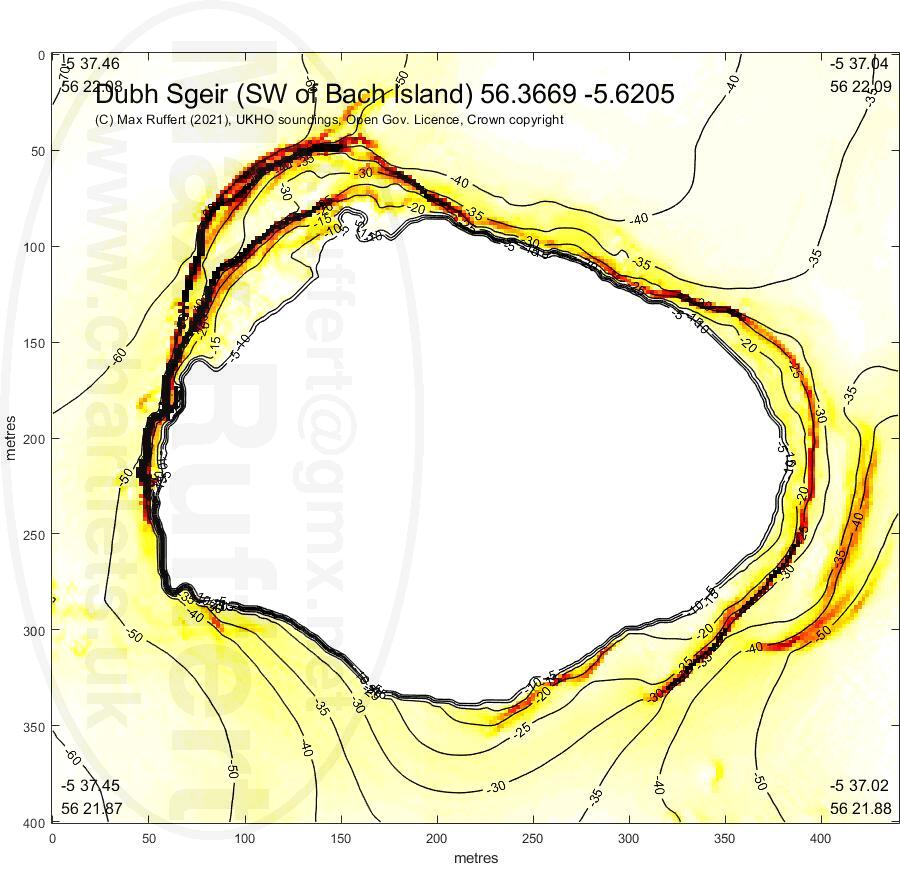
Dubh Sgeir (SW Bach) |
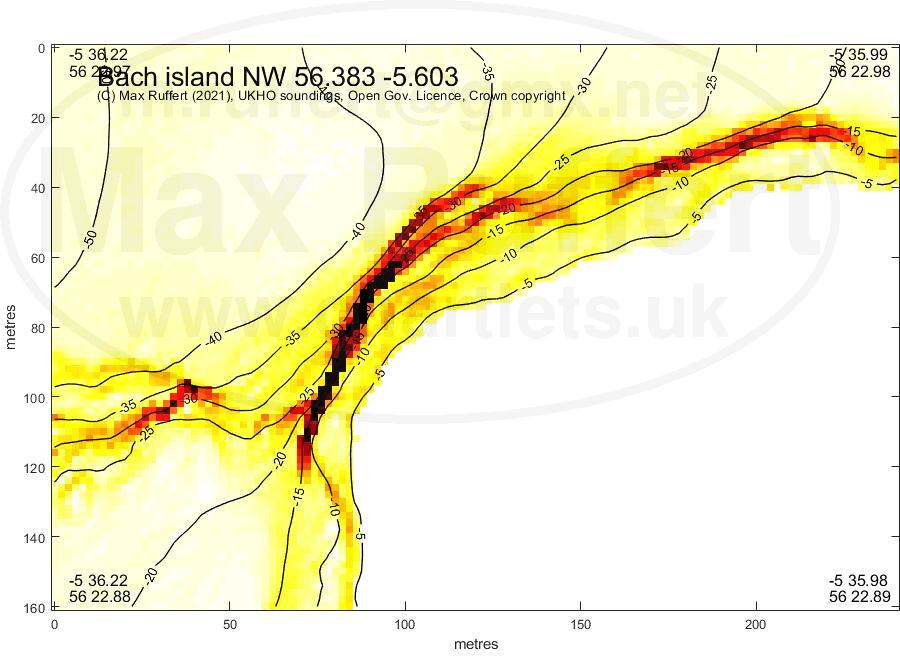
Bach Is. NW |
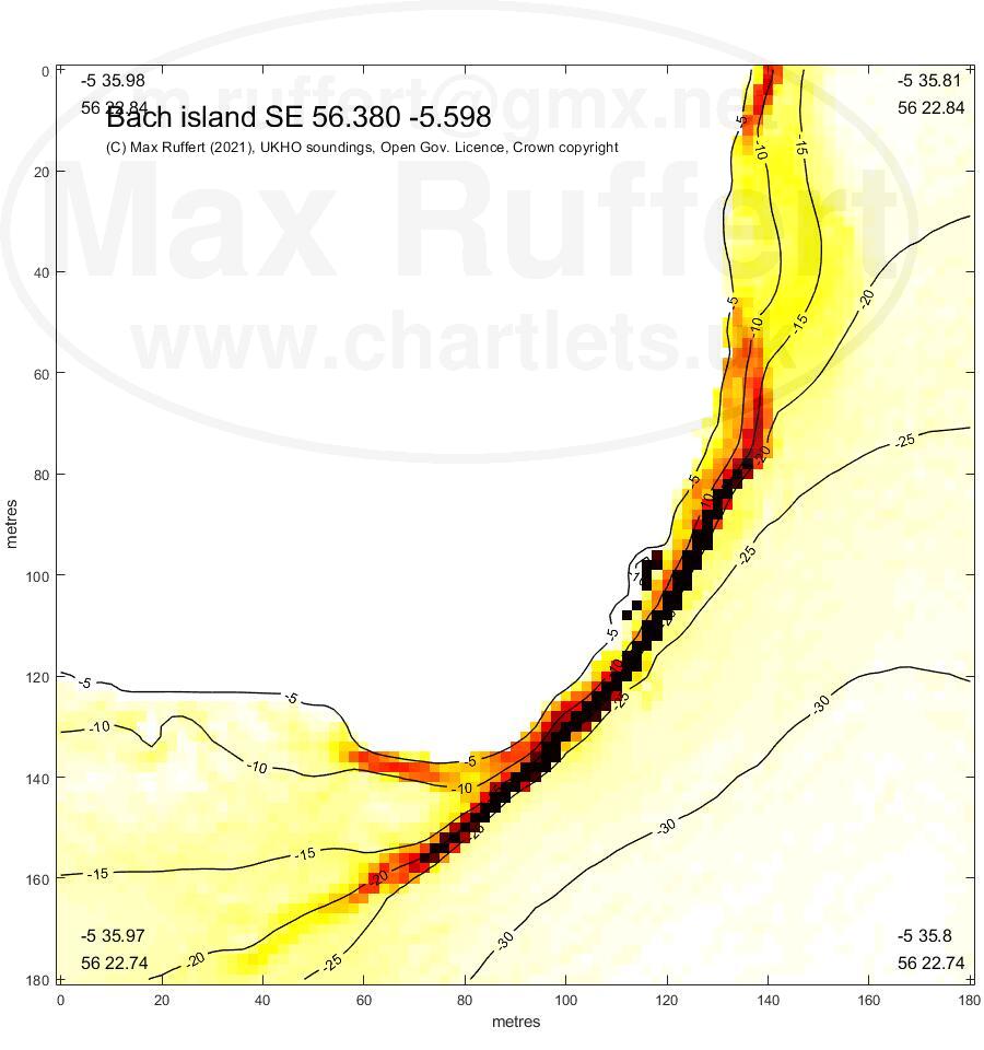
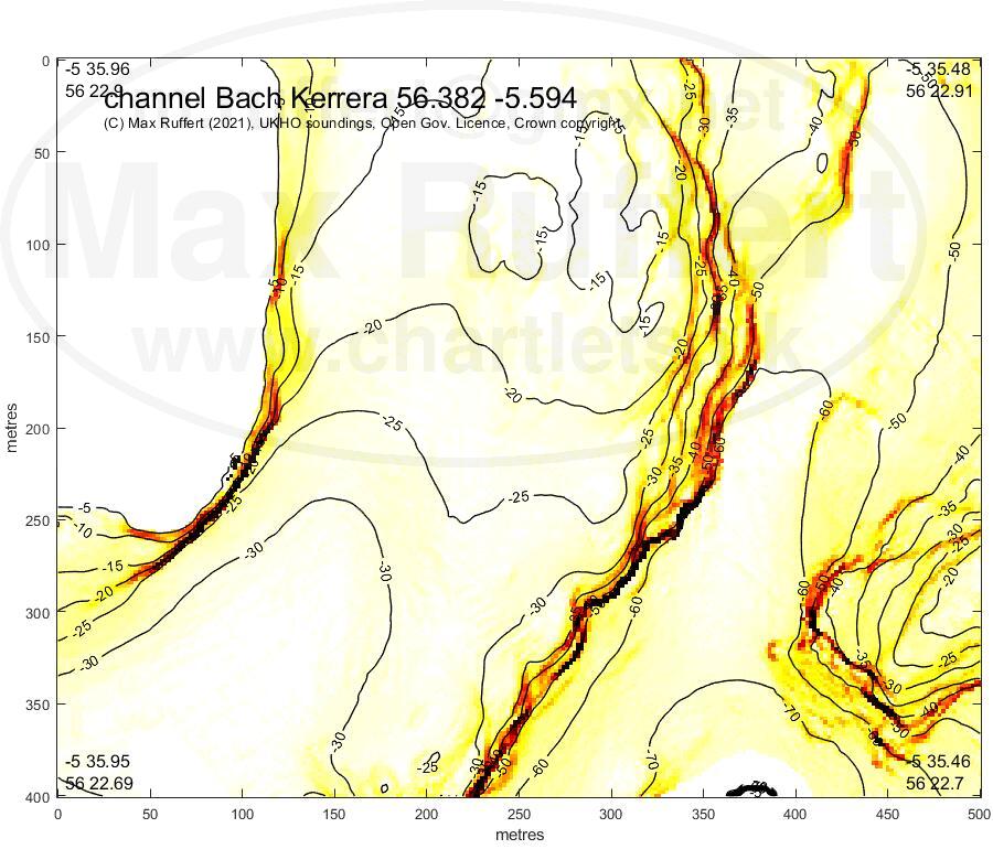
Bach Is. SE | Bach channel |
|---|---|---|---|---|
 |
 |
 |
 |
 |
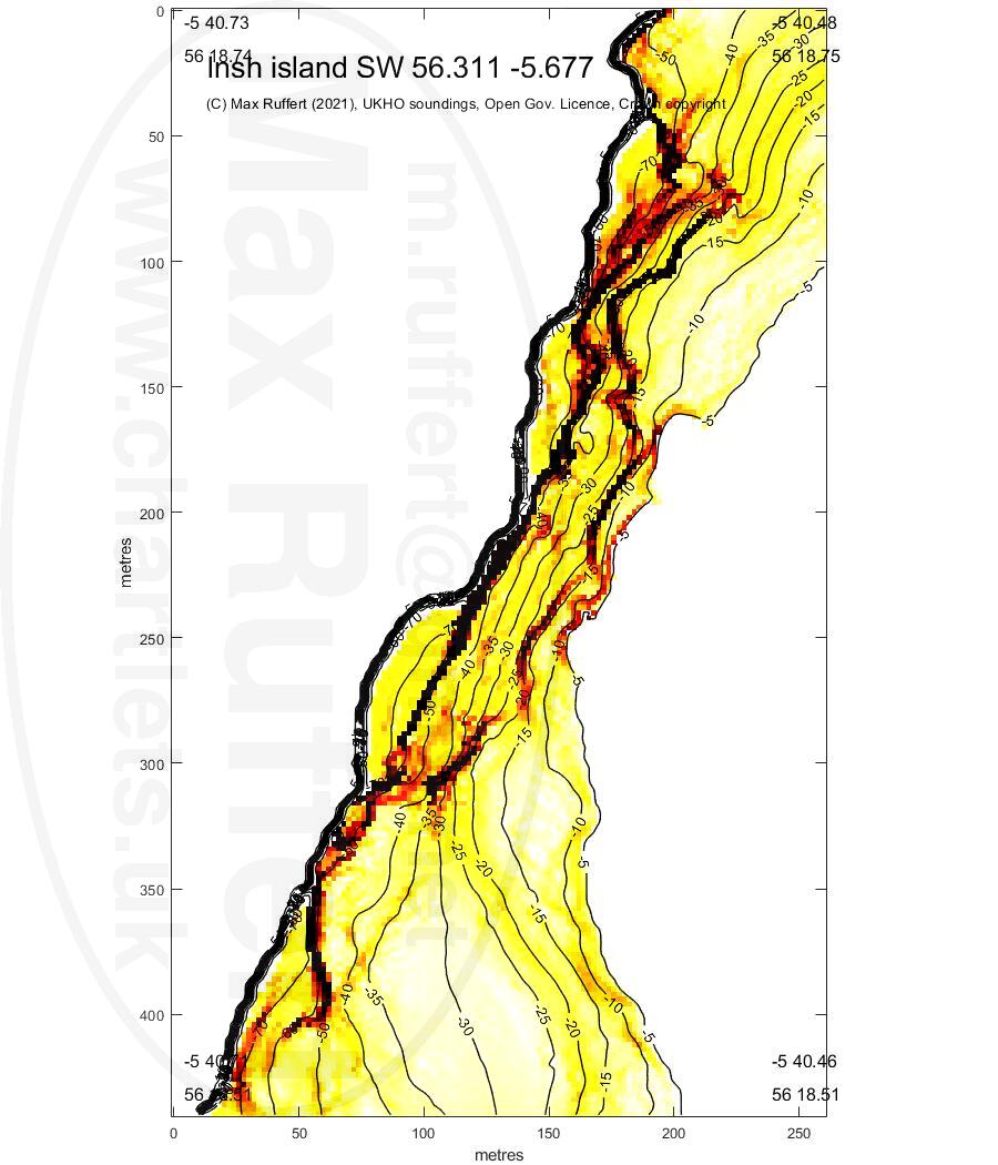
Insh Is. SW |
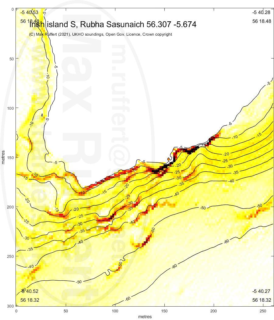
Insh Is. S |
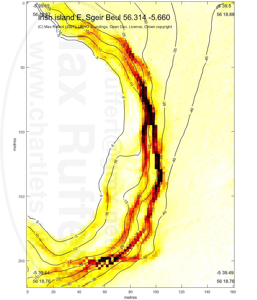
Insh Is. NE |
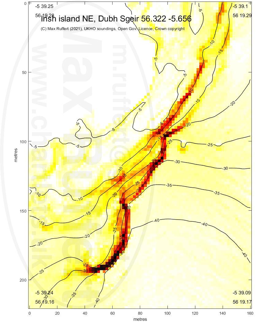
Insh Is. Dubh Sgeir |
|---|---|---|---|
 |
 |
 |
 |
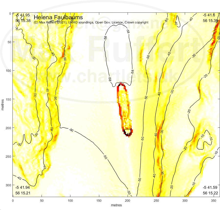
Helena Faulbaums |
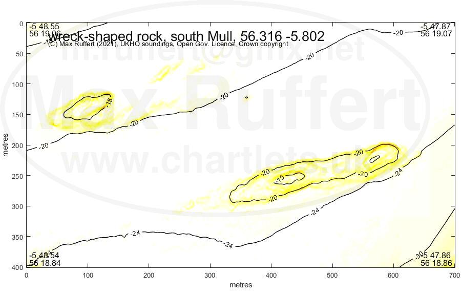
wreck rock Mull S |
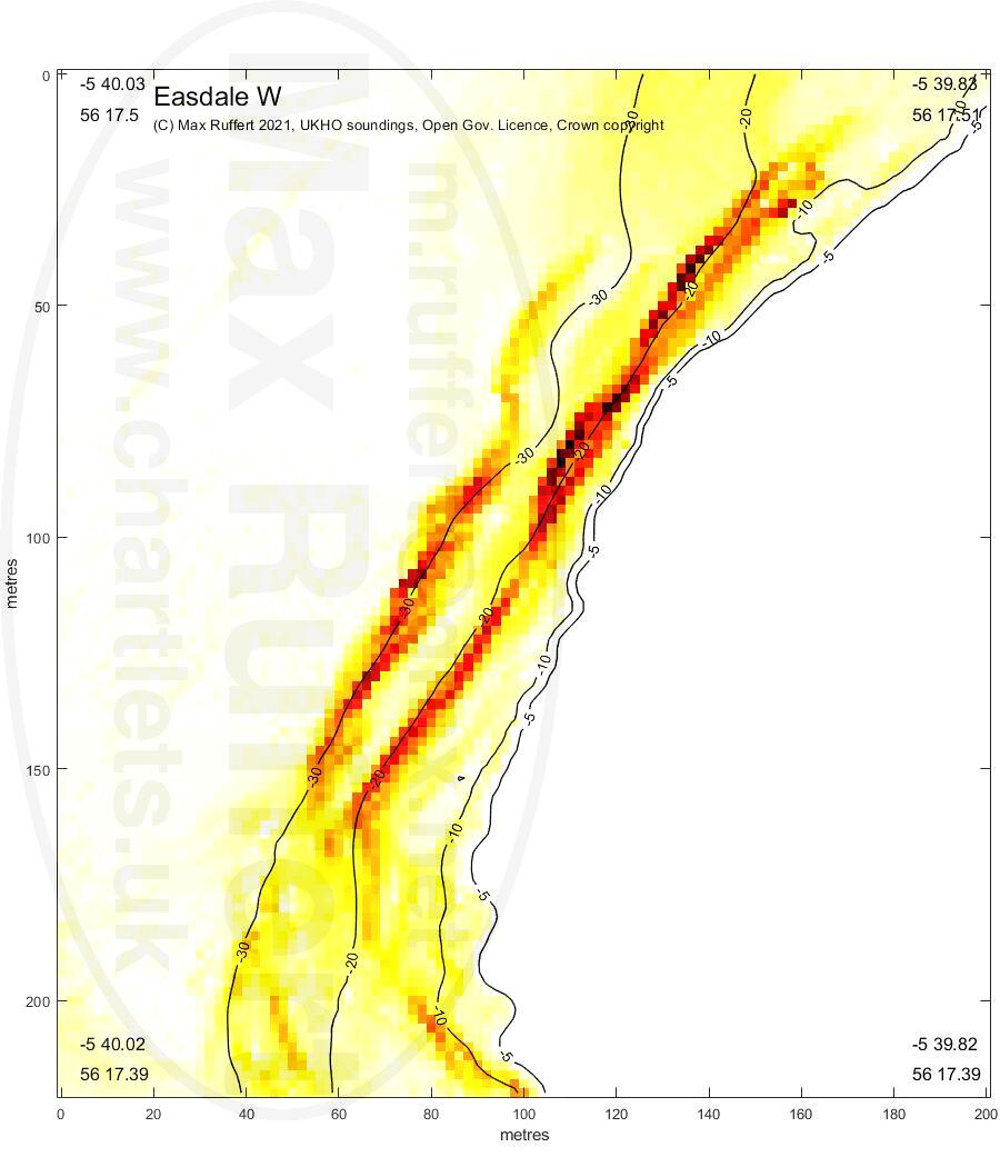
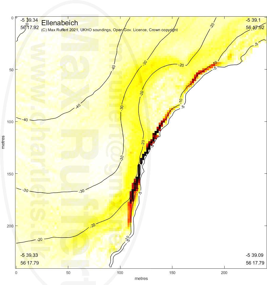
Easdale W | Ellenabeich |
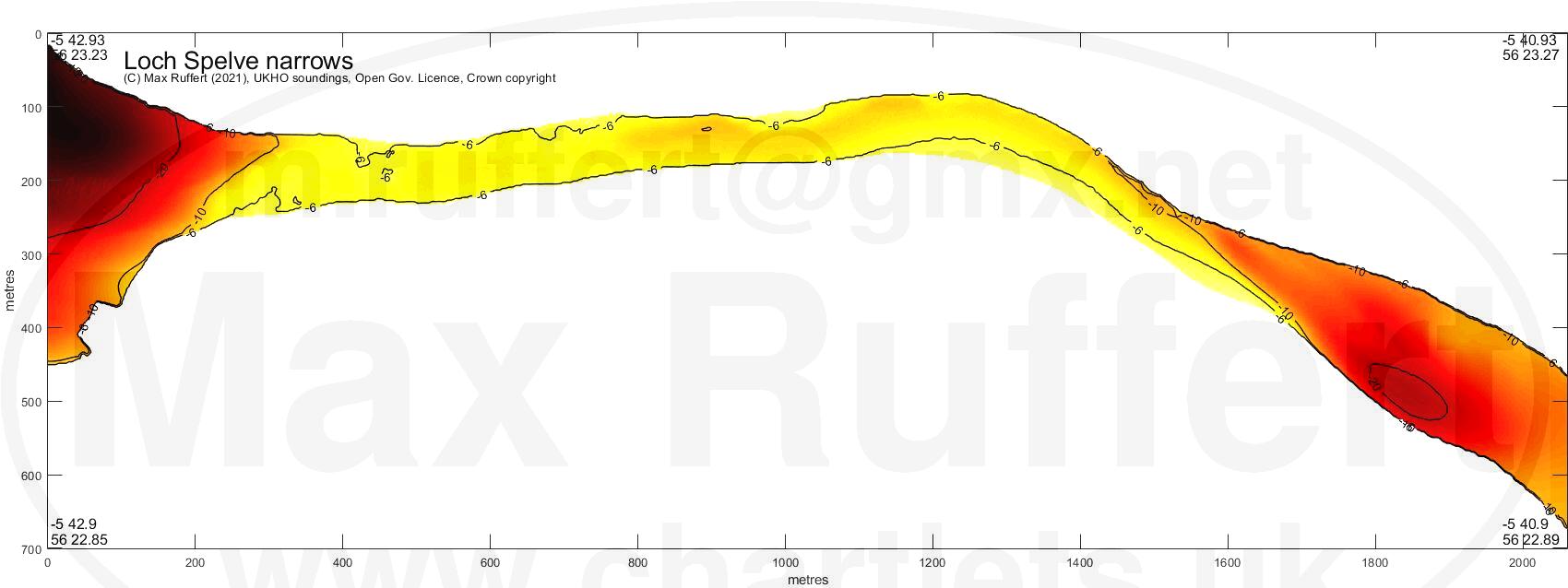
Loch Spelve narrows |
|---|---|---|---|---|
|  |
 |
 |
 |
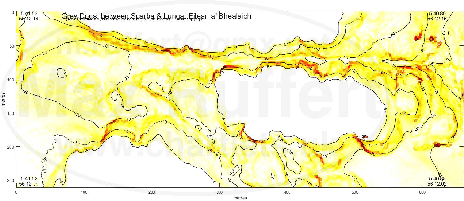
Grey Dogs |
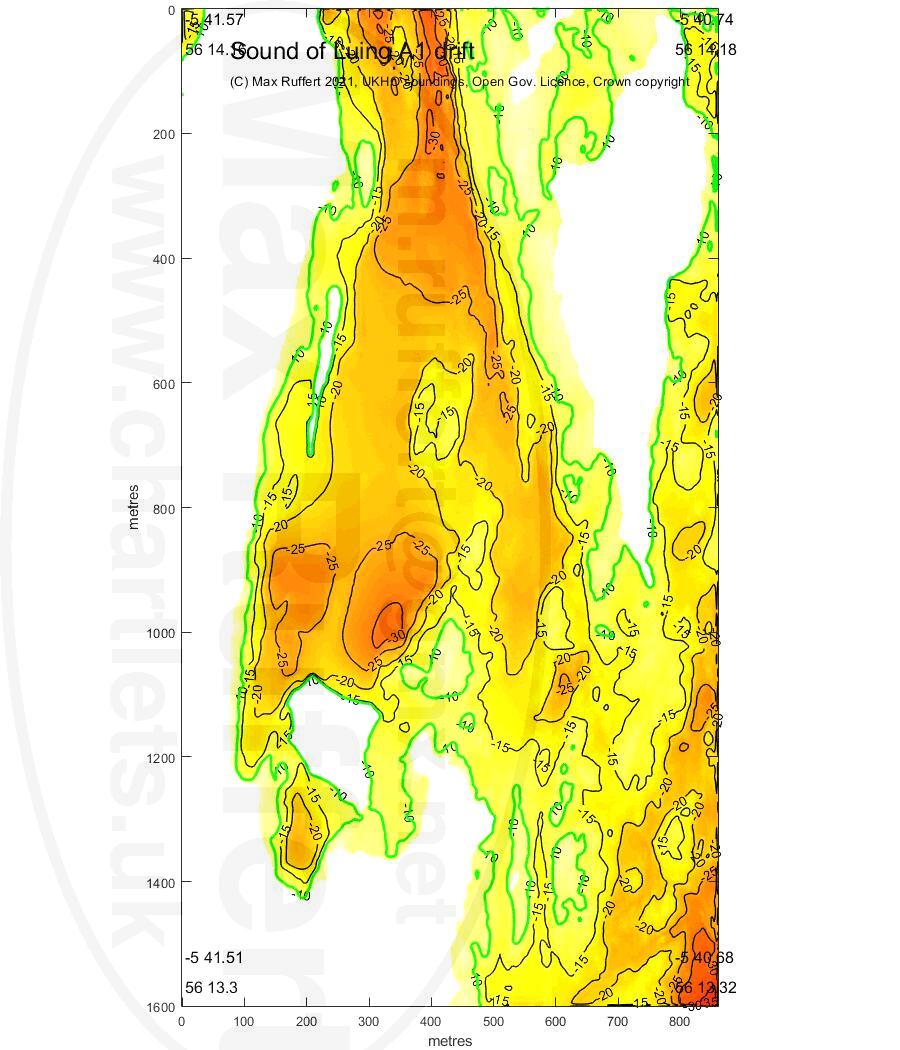
A1 drift |
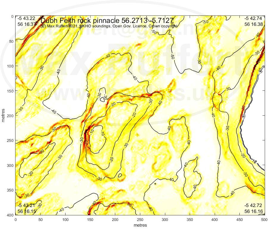
Dubh Feith |
Bono Rock |
|---|---|---|---|
|  |
 |
 |
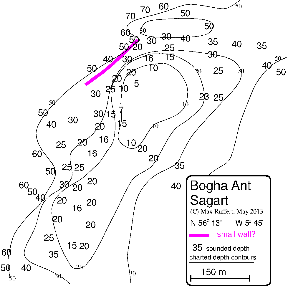
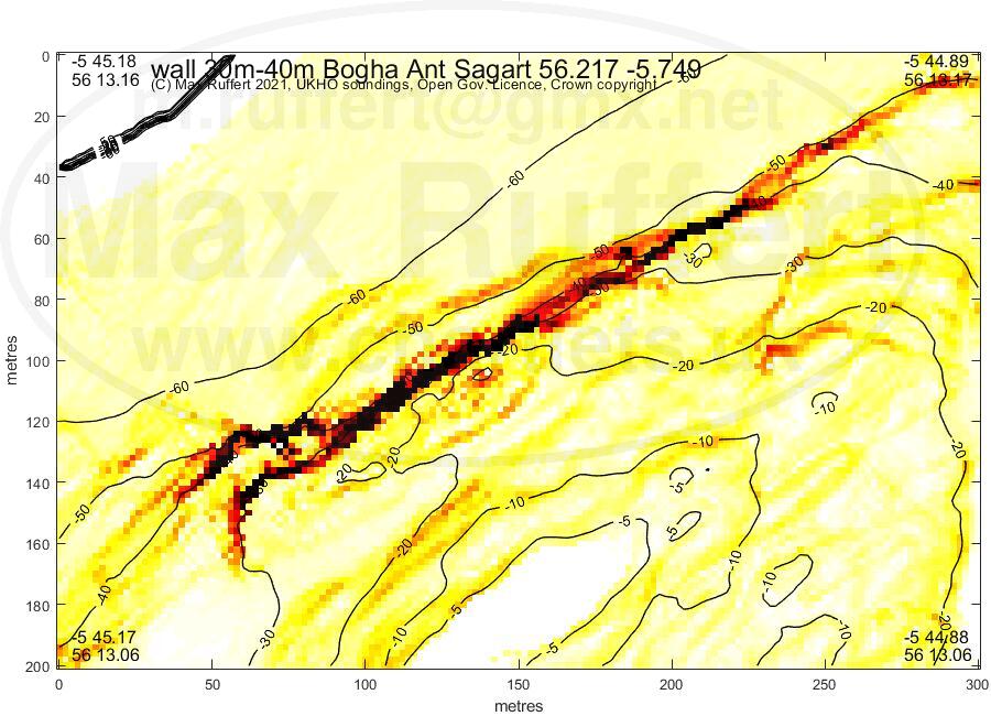
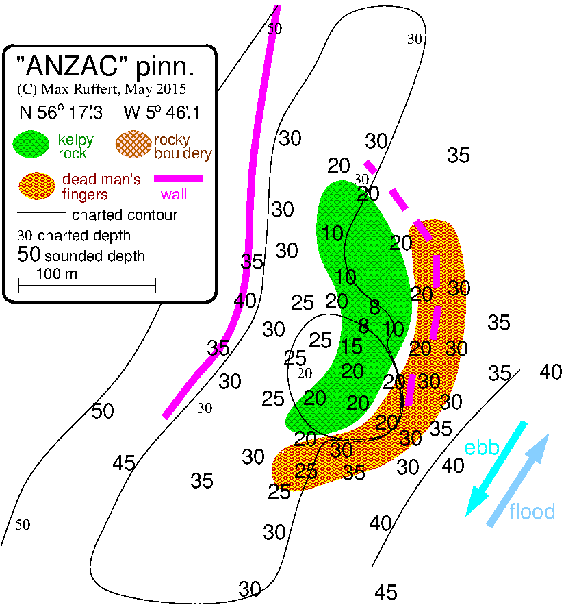
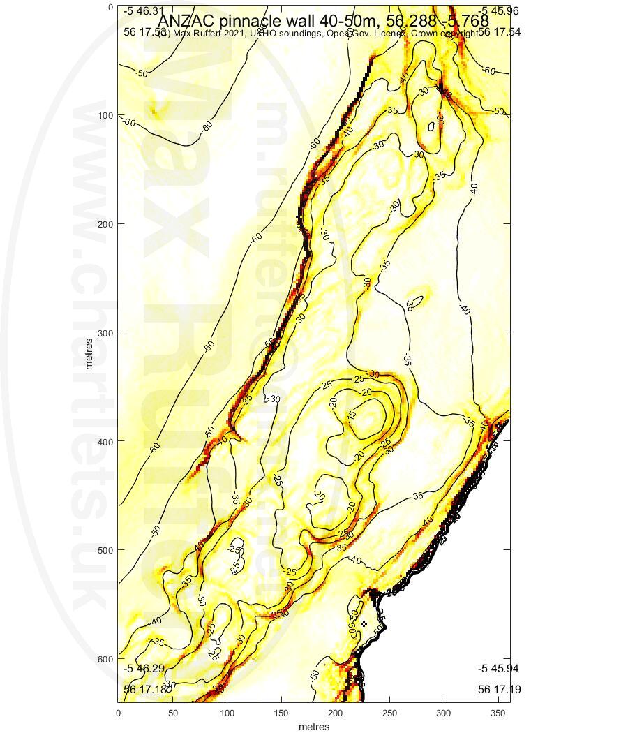
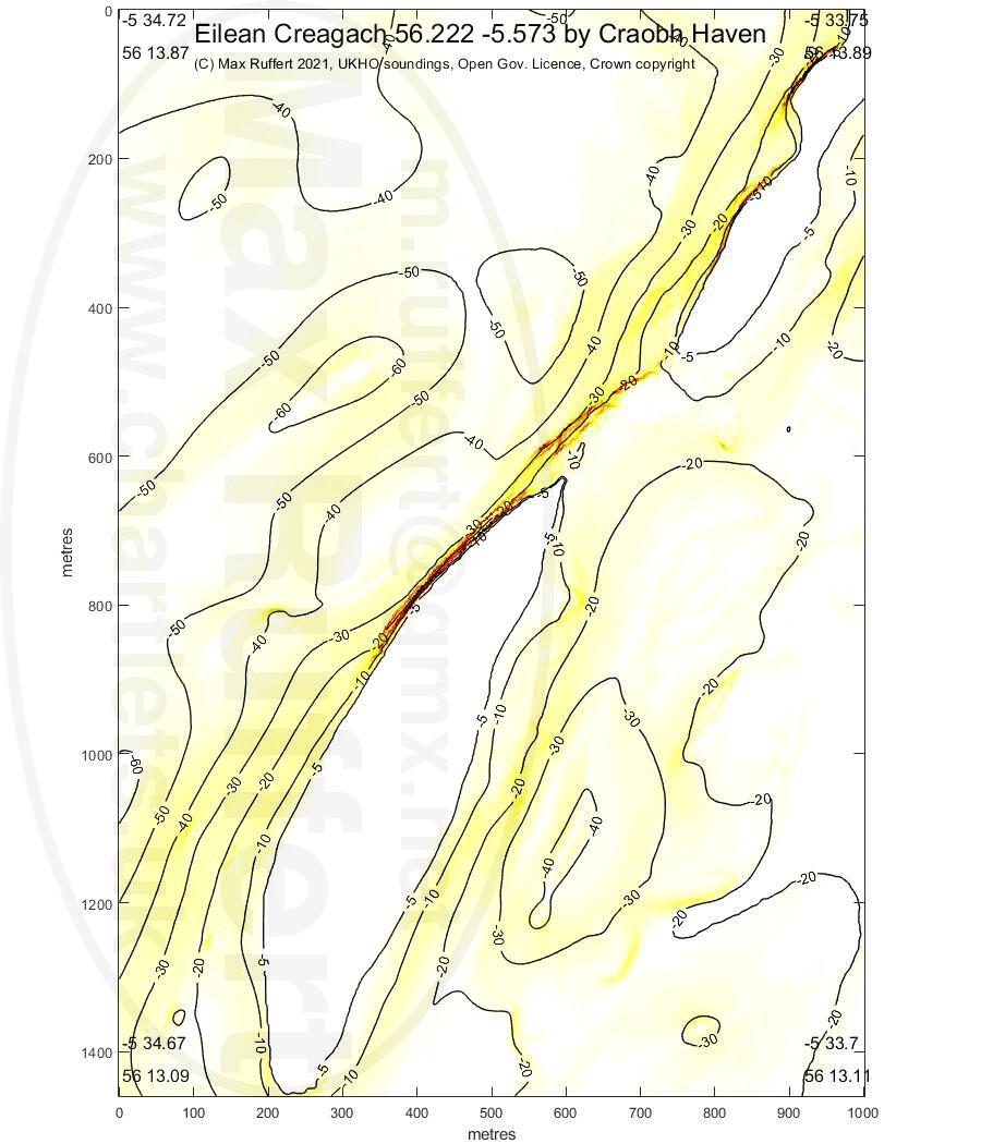
Bogha Ant Sagart | ANZAC Pinnacle | Eilean Creagach | |||
|---|---|---|---|---|---|
 |
 |
 |
 |
 |
 |
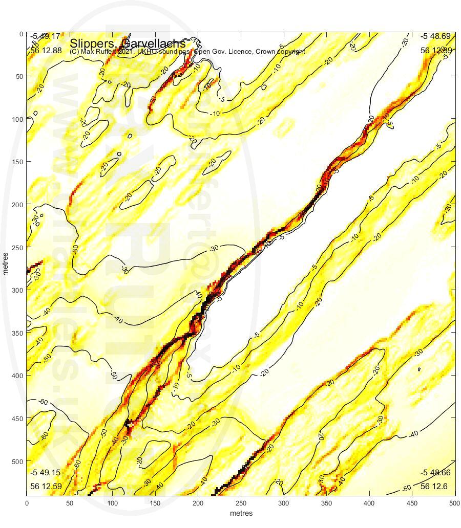
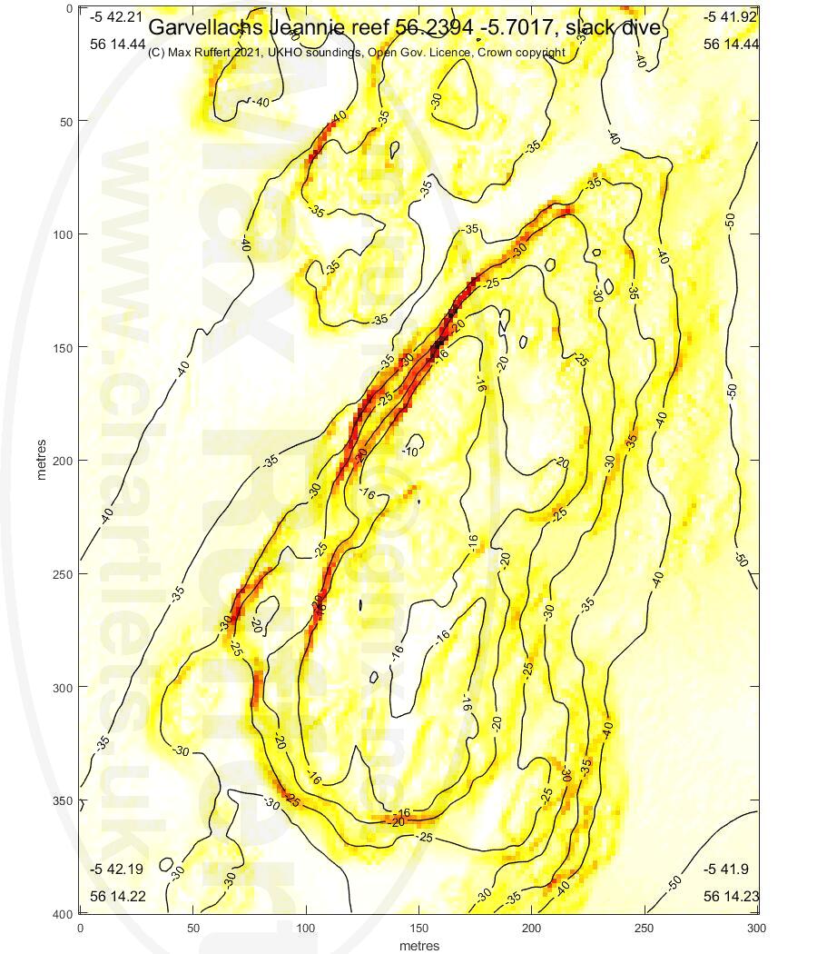
Slippers | Jeannie |
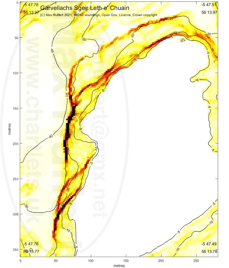
Half Moon | Chuain |
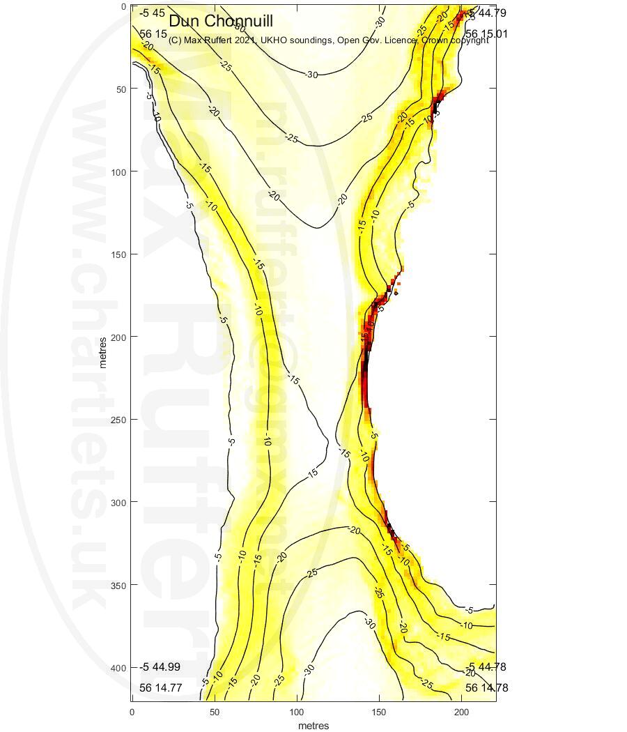
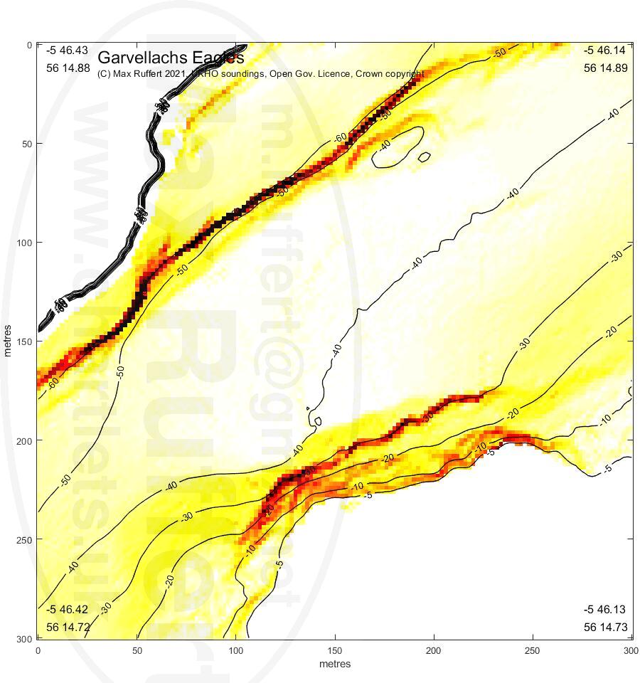
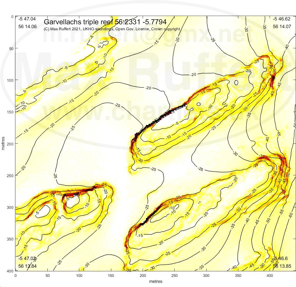
Dun Chonnuill | Eagles |
Conger reef |
|---|---|---|---|---|---|---|
 |
 |
 |
 |
 |
 |
 |
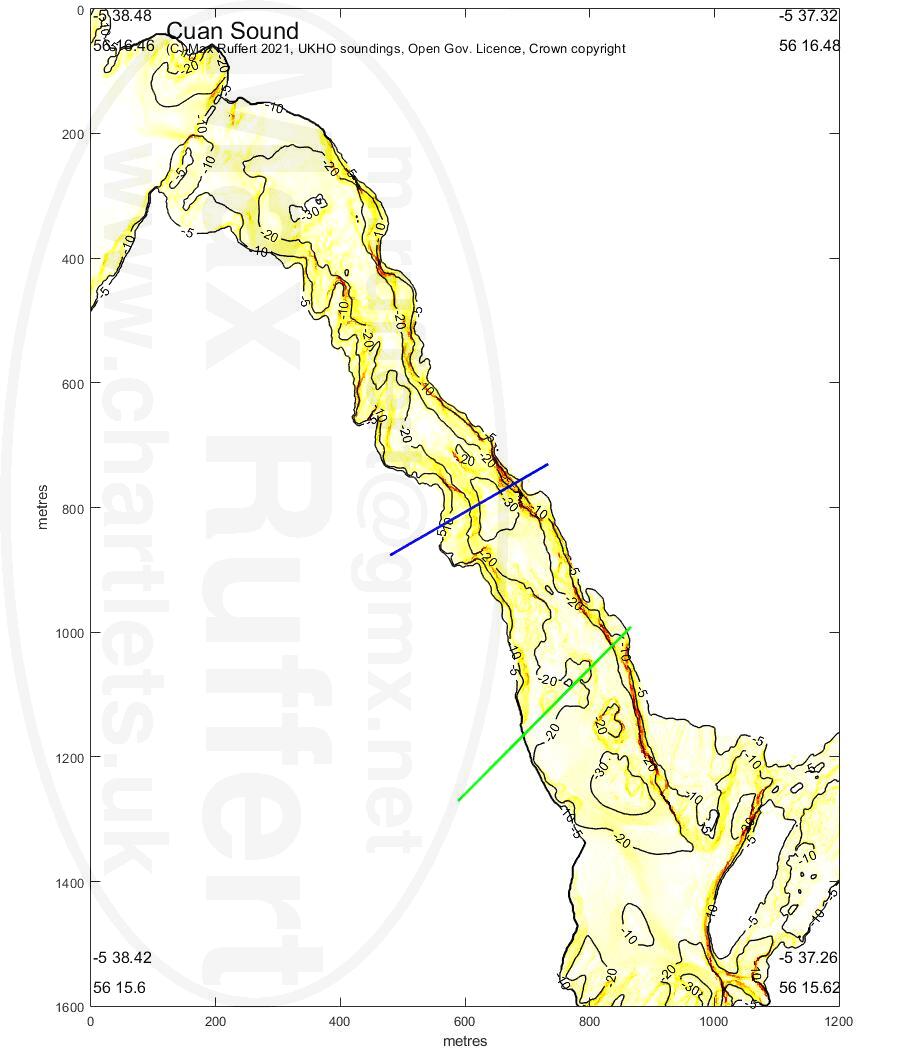
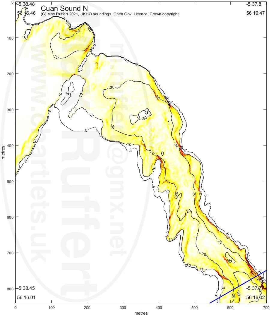
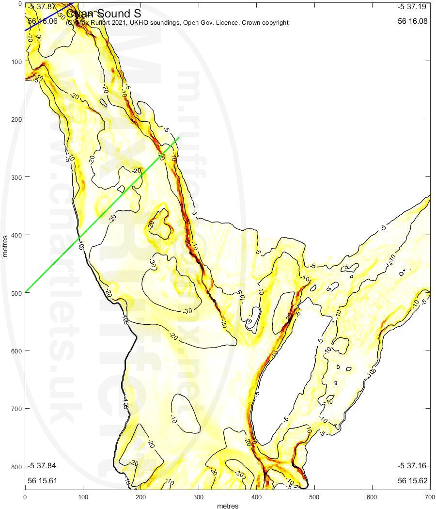
whole sound |
north Cuan | south Cuan |
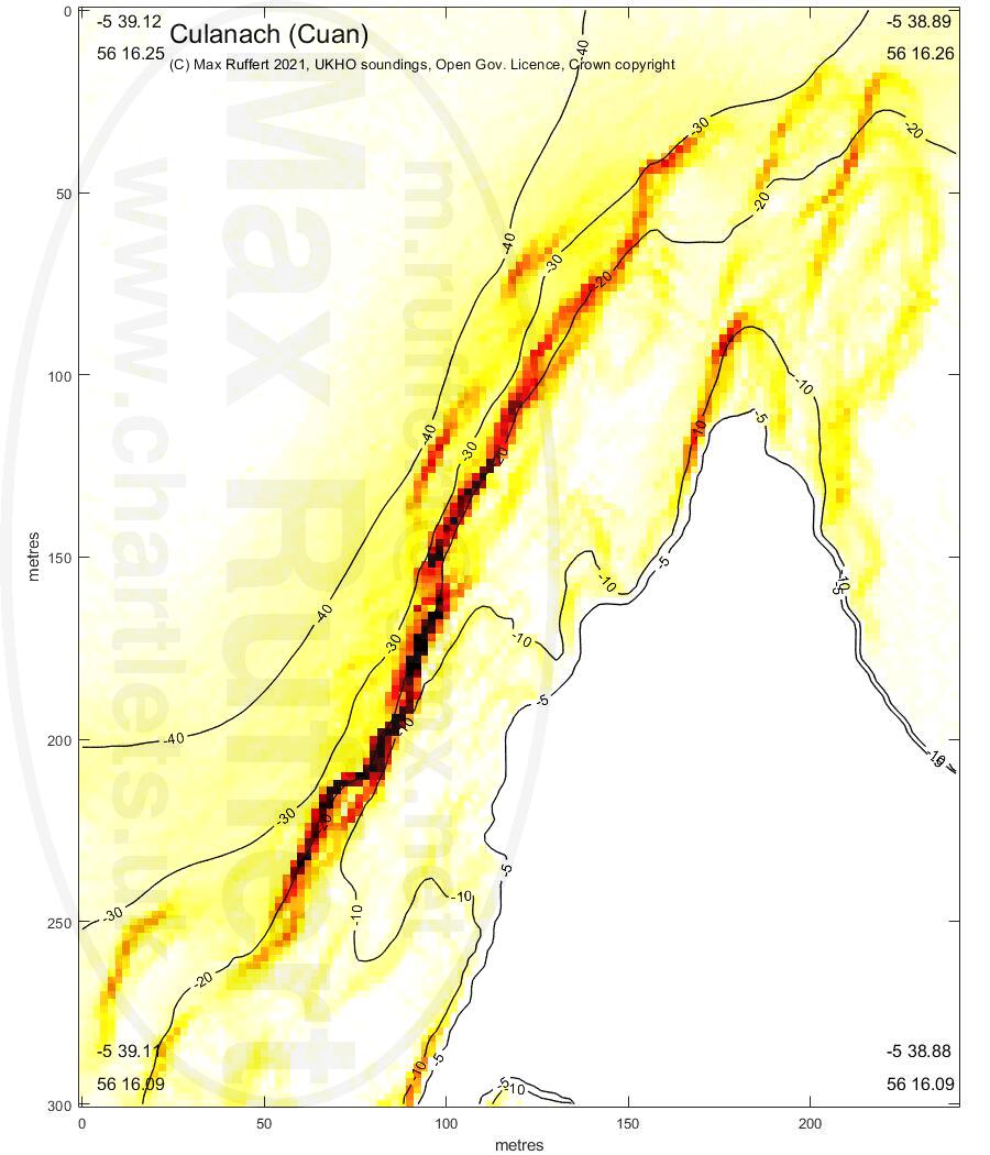
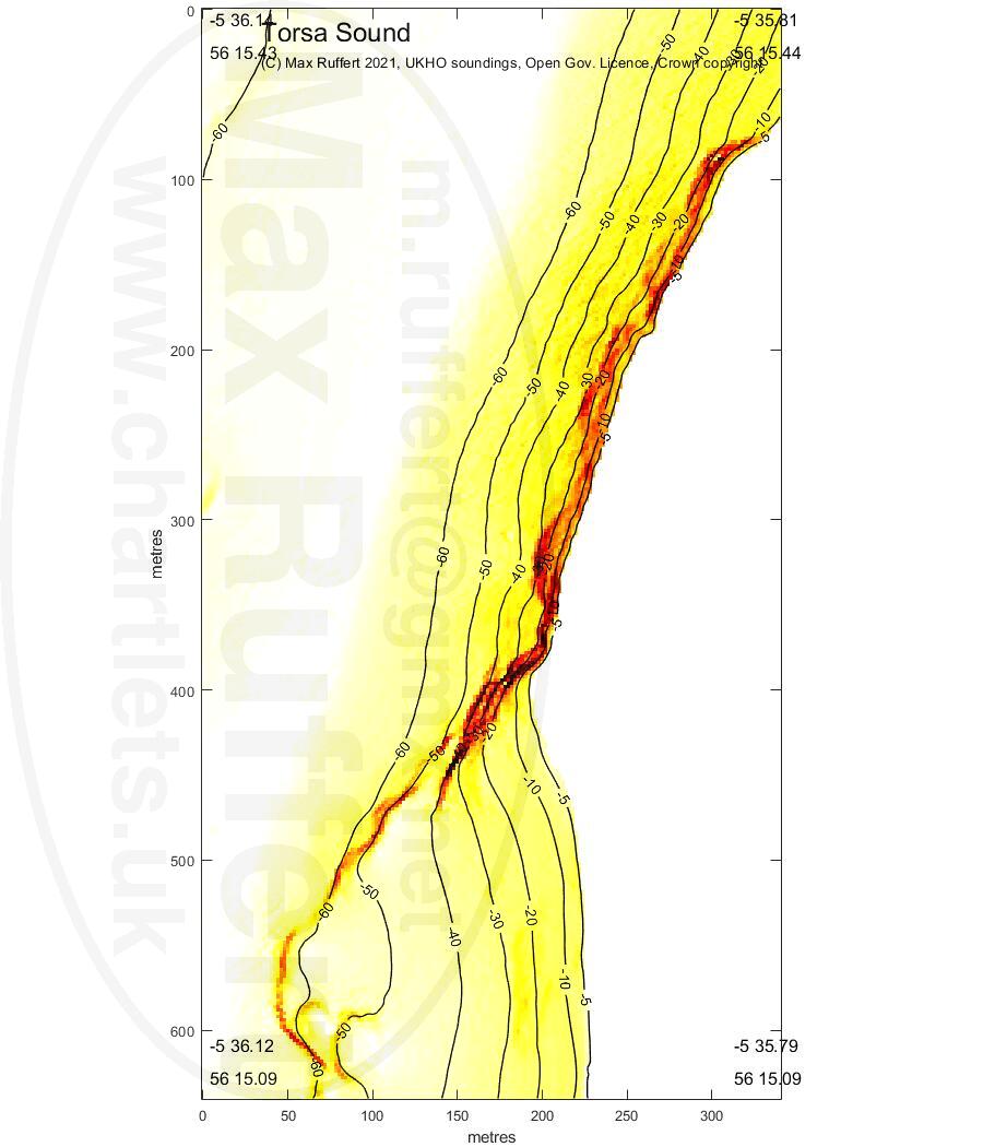
Culanach | across from Torsa |
|---|---|---|---|---|
 |
 |
 |
 |
 |
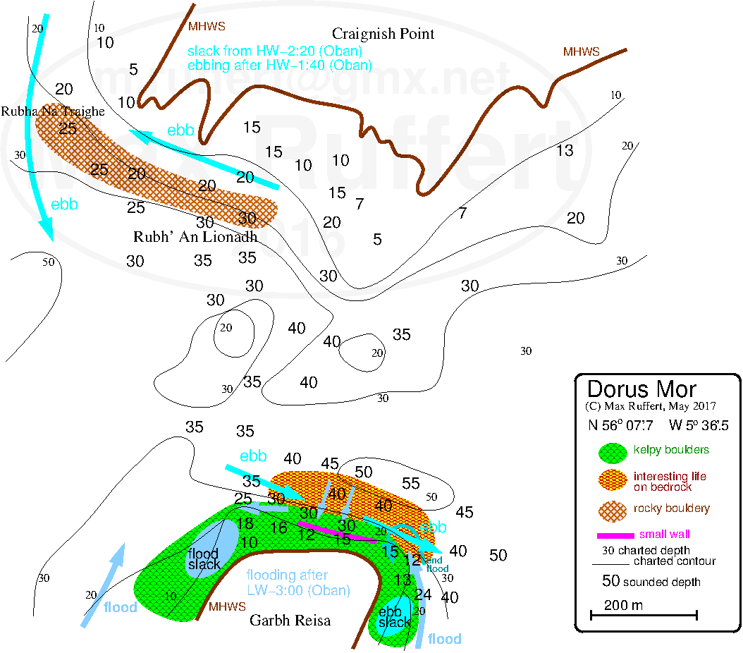
Dorus Mor |
Reisa An T-Sruith | |
|---|---|---|
 |
 |
 |
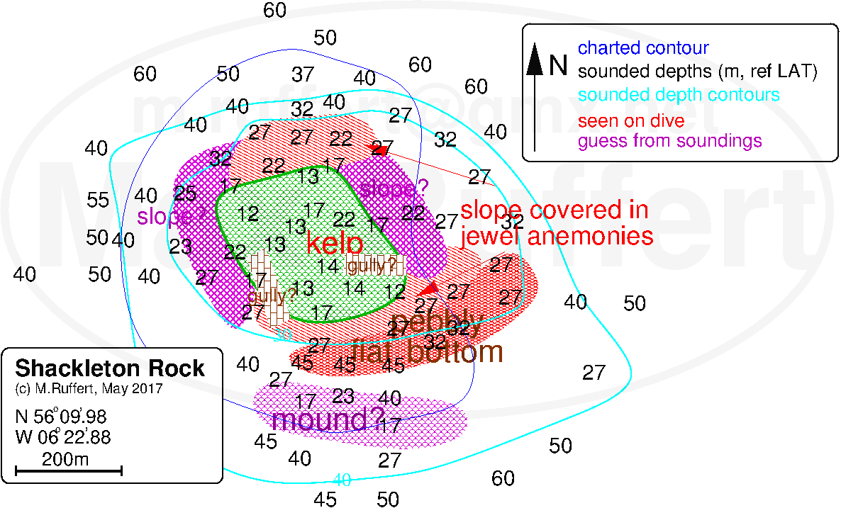
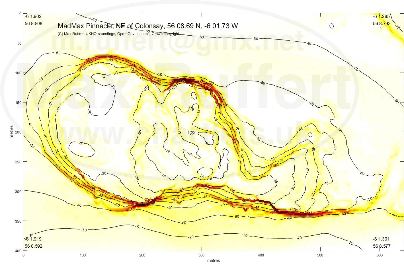
Shackleton Rock | MadMax Pinnacle | ||
|---|---|---|---|
 |

| 
|  |
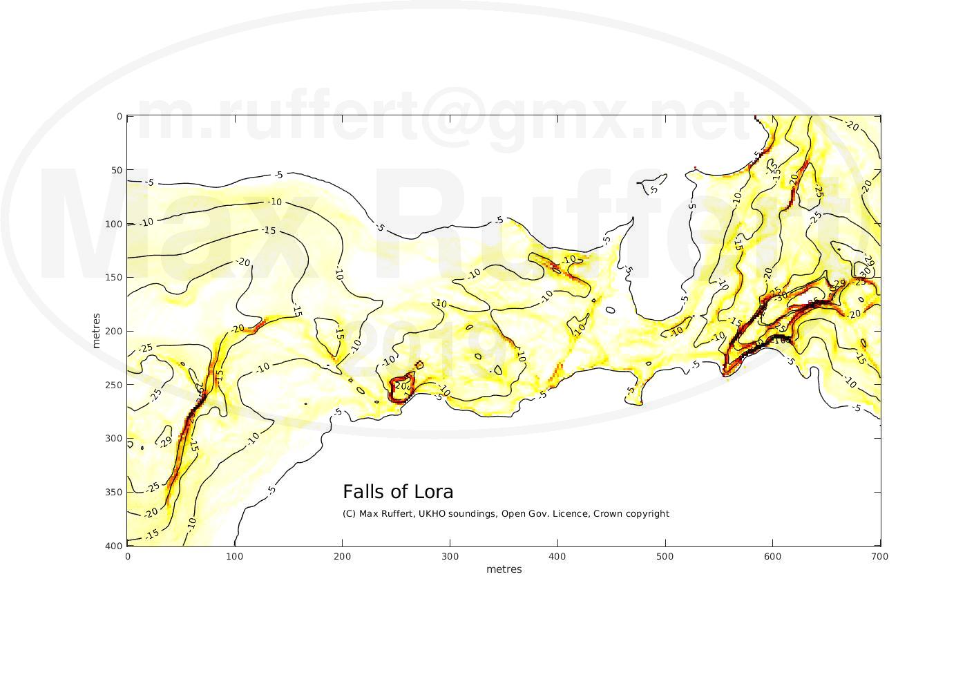
The data shown here should only be understood as exercise in depth sounding / charting / bathymetry and should not be relied upon for activities where safety is critical.
Comments welcome to m.ruffert (at) gmx.net